Get the free Morning Headlines email for news from our reporters across the world
Sign up to our free Morning Headlines email
Sign up to our free Morning Headlines email
Storm Claudia is set to hit the UK today as the Met Office issued amber weather warnings, forecasting heavy rain will lead to flooding and disruption across the country.
The amber warnings are in place from midday to midnight on Friday, with 50 to 75mm of rain forecasted for Wales with with some higher ground likely seeing 100-150 mm and 40 to 80mm expected in the East Midlands, the east of England, London and southeast England, northwest England, southwest England, Wales, and the West Midlands.
Some 20 flood warnings and 33 flood alerts have also been flagged as Storm Claudia, named by the Spanish Meteorological Service, makes its way towards the UK.
open image in gallery
Vehicles drive through rain on the A38 in Plymouth, Devon, earlier this year (Ben Birchall/PA)
A 24-hour yellow weather warning for rain has also been issued from 6am on Friday in the southern part of the country.
A yellow rain warning is currently in place in central, Tayside and Fife, northeast England, northwest England, southwest Scotland, and Strathclyde until 7pm on Thursday. A total of 15 to 25mm of rain is expected, with some areas in southern Scotland potentially seeing around 40 to 60mm.
open image in gallery
The Met Office has issued yellow and amber weather warnings for Friday (The Met Office)
Met Office chief meteorologist Matthew Lehnert said: “Storm Claudia will bring very heavy rainfall to a large swathe of central and southern England and Wales on Friday into Saturday. This rain will become slow-moving, and some areas could see up to a month’s worth of rain in 24 hours.
“Much of this will fall on saturated ground, increasing the chances of flooding and contributing to the amber warnings we have issued.
“Within the Amber warning areas, some could see in excess of 150mm accumulate during the event, with 60-80mm fairly widely. Gusty winds in the northwest of England and northwest Wales is an additional hazard, with 60-70mph gusts possible in exposed places within the warning area.”
In areas under an amber warning, the Met Office is cautioning that fast-flowing or deep floodwater is likely and could cause danger to life.
open image in gallery
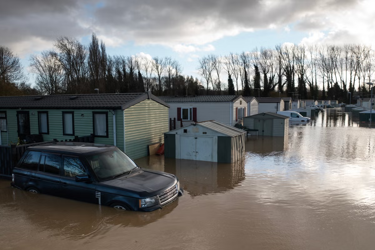
(Getty Images)
Homes and businesses are expected to be flooded and the weather agency has also warned of travel disruption and power cuts in affected areas.
The impacts may be exacerbated by strong easterly winds, as well as thunderstorms arriving on Friday afternoon, it said.
Alun Attwood from Natural Resources Wales said: “We’re urging people to be vigilant and to make preparations for potential flooding now. You can check if you live in an area at risk of flooding on our website and sign up for our free flood warning service.
“We do not provide flood warnings for flooding from surface water, so it’s important for everyone to know their flood risk.”
open image in gallery
Unsettled weather is expected throughout the week (PA)
Here is the weather forecast for the UK for the coming week, according to the Met Office:
Today
A very wet day across parts of England and Wales with a strong easterly wind developing. A colder day for Scotland and Northern Ireland with sunny spells and isolated showers.
Outlook for Saturday to Monday
Rather cloudy and damp on Saturday across southern and central areas, but colder and clearer conditions further north will spread southwards during Sunday. Cold and bright for many on Monday.