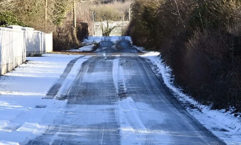
A status yellow snow and ice warning has been issued for several counties for Wednesday into Thursday, with Met Éireann warning of “wintry showers of hail, sleet and snow” and hazardous travelling conditions.
The warning, which affects Cavan, Donegal, Monaghan, Leitrim, and Sligo, will be in place from midnight on Wednesday until midday on Thursday.
During this time, the forecaster is warning of hail, sleet, and snow in affected areas, as well as icy stretches, and some “modest accumulations” of snow and sleet, especially on high ground.
A separate warning was also issued by the UK Met Office across all counties in Northern Ireland, to be in place midday.
Status Yellow -Snow-Ice warning for Cavan, Donegal, Monaghan, Leitrim, Sligo
Impacts:
Hazardous travelling conditions.
Icy stretches
Valid: 00:00 Wed19/11 to 12:00 Thurs 20/11
Warning details ➡️https://t.co/t2JoveRUyC pic.twitter.com/nCpbOXr2c2
— Met Éireann (@MetEireann) November 18, 2025
As for the general outlook for the coming days, Met Éireann says temperatures will range from 3C to -1C, with a possibility of some scattered showers turning wintry with “hail and sleet, and possibly some snow too, especially about higher ground”.
Wednesday will also be quite cold, with sunshine and scattered showers, some of them wintry with hail and sleet. There will be some further snow showers, mainly over higher ground in the north and northwest.
Highest temperatures on Wednesday will range from just 3C to 7C, and it will feel even colder with an added wind chill factor.
Wednesday night will bring clear spells and further scattered showers, mainly in the north and west of the country. Again, some of the showers will be wintry, especially in Ulster, though the showers will become increasingly isolated overnight. The mercury is likely to fall back to between -3C to 2C on Wednesday night, with the coldest conditions likely to be felt in the east and south. Met Éireann also says “fairly widespread frost and some icy patches” will develop on Wednesday night.
Thursday too will be quite cold and frosty, with sunny spells. Showers, mainly in the west and north, some of them still wintry, will become increasingly isolated as the day goes on. Daytime temperatures on Thursday are unlikely to surpass 3C to 7C in light to moderate northwesterly breezes.
By Thursday evening, the forecaster says the temperature will again drop significantly, amid clear skies and light variable breezes. Cloud will gradually thicken from the west overnight, with patchy rain and drizzle developing near Atlantic coasts towards morning. Lowest temperatures on Thursday night will once again hover between -3C and 2C, with further frost and icy patches expected.
Friday will be a mostly cloudy to begin, with outbreaks of rain and drizzle gradually spreading eastwards over the country through the morning and afternoon. According to Met Éireann, “freshening southerly winds will usher in milder Atlantic air with the rain”.
Daytime temperatures on Friday will range from about 4C or 5C in the northeast to 10C or 11C near western and southwestern coasts. Remaining rain and drizzle will then clear the east coast early on Friday night, with clear spells and a few showers following. At this stage, Friday night is expected to be cold, though with temperatures likely to range from 2C to 7C, not as cold as previous nights.