Thunderstorm activity is once again ramping up across eastern Australia, and severe thunderstorms are possible for parts of Queensland and New South Wales in the coming days. Let’s begin with a look at the thunderstorm outlook maps, starting off with Saturday. We can see thunderstorms are possible for both central and eastern parts of the country, but for this update, we’ll just be focusing on the eastern states.
Thunderstorms are possible today all the way from central Queensland down to New South Wales, even dipping into northern parts of Victoria. We also have an area in yellow where severe thunderstorms are possible, and if we zoom in on the map there, we can see that severe thunderstorms are possible through the rest of the day all the way from Roma down through the Western Downs and into northern inland parts of New South Wales. This includes Moree, Tamworth, Inverell, Narrabri, as well as down into the Central Tablelands including Bathurst. Through these areas the main risk will be heavy rainfall, damaging winds and large hail, and for severe thunderstorms closer to the Macquarie Coast, heavy rainfall will be the primary risk.
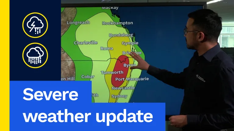
As we head into Sunday, the area of thunderstorms expands all the way to the coast. Again, all the way from central Queensland to much of New South Wales, even getting into eastern parts of Victoria. Severe thunderstorms are again possible all the way from south-eastern and inland parts of southern Queensland. We could even see severe thunderstorms across the western suburbs of Brisbane, then all the way down the coast including Newcastle, Sydney and Wollongong. Severe thunderstorms are likely in this red area from the southern Granite Belt and down into the Northern Tablelands of New South Wales. These thunderstorms on Sunday could again bring heavy rainfall, damaging winds and large hail.
As we head into the early part of next week, thunderstorms are again possible over large parts of eastern and central Australia, even getting down towards Melbourne and the far northwest corner of Tasmania. The focus will be across north-eastern parts of New South Wales as well as south-eastern Queensland. This weather is typical for this time of year, but severe thunderstorms can still produce significant impacts. Heavy rainfall can lead to flash flooding, which can cause transport disruptions. Winds can cause damage to trees and property as well as cause power outages, and large hail can cause damage to property and vehicles. Keep an eye on the latest forecast and warnings as we head through the weekend and into early next week.
Now let’s have a look at the synoptic maps on a day-by-day basis. Starting off with Saturday, we see a number of troughs through central and eastern parts of Australia. That is generating very unsettled conditions, and we can see widespread showers and thunderstorms all the way into Saturday evening and Saturday night. As we head to Sunday morning, showers and storms basically merge and become areas of rain across eastern Victoria and New South Wales. That trough pushes off the coast, but into Sunday afternoon and evening we will see another round of thunderstorms developing across the eastern seaboard. As we head into Monday, again we see thunderstorms developing from the afternoon and into the evening across a very broad area, with a number of troughs continuing to drag down tropical moisture all the way from the north of the country.
For large parts of eastern Australia, we are looking at severe thunderstorms again over the weekend and into early next week. For the latest updates and information, check out our website and app, follow us on social media and please stay safe.