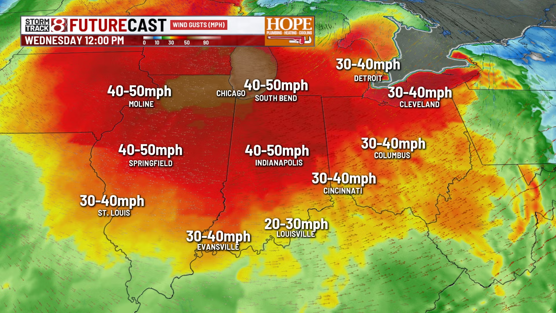
INDIANAPOLIS (WISH) — It’s a Storm Track 8 weather alert day with a wind advisory in effect from 7 AM to 7 PM Wednesday.
Sustained winds are expected to reach 20–30 mph, with gusts of 40–50 mph. With the wind direction coming out of the west and eventually northwest, travel could be rough on north/south roads, especially for high-profile vehicles.
Today:
Temperatures are falling into the upper 30s this morning and are expected to hold steady throughout the day. Flurries are possible for much of the area, mainly north of I-74, with a few snow showers possible in the far north and northeast, causing brief visibility drops.
Wind chills will remain in the low to mid 20s, and the day will be cloudy and sharply colder following an early-morning cold front.
Tonight:
Winds will ease slightly but remain brisk, with gusts between 15 and 20 mph. Lows will drop to the low to mid 20s, and wind chills could fall to the single digits in spots.
Thursday:
Thanksgiving Day will be sunny but cold, with highs in the 30s and breezy conditions resulting in wind chills in the 20s.
Friday:
Friday will be cold but quiet, with highs in the low to mid 30s, light winds, and sunshine, making it the best day of the holiday weekend.
Weekend storm system:
A new weather system is expected to arrive late Friday night into Saturday, bringing likely snow at the start with a light accumulating snowfall possible. Current trends suggest 1–2 inches north of I-70, with less than 1 inch south.
Saturday morning may see travel impacts from wet, slushy snow, but warmer air is expected to push in from the south during the afternoon and evening, transitioning the precipitation from snow to a mix and then to rain.
By early Sunday, most areas should experience mainly rain, with temperatures rising into the mid 30s to lower 40s early, then falling later in the day. A few light rain or snow showers are possible Sunday night.
7 day forecast:
Early next week is expected to be colder and wintry, with highs below freezing for many areas on Monday and Tuesday, and lows in the teens. Another system may bring a wintry mix or snow early next week, as early December looks cold, active, and unsettled.