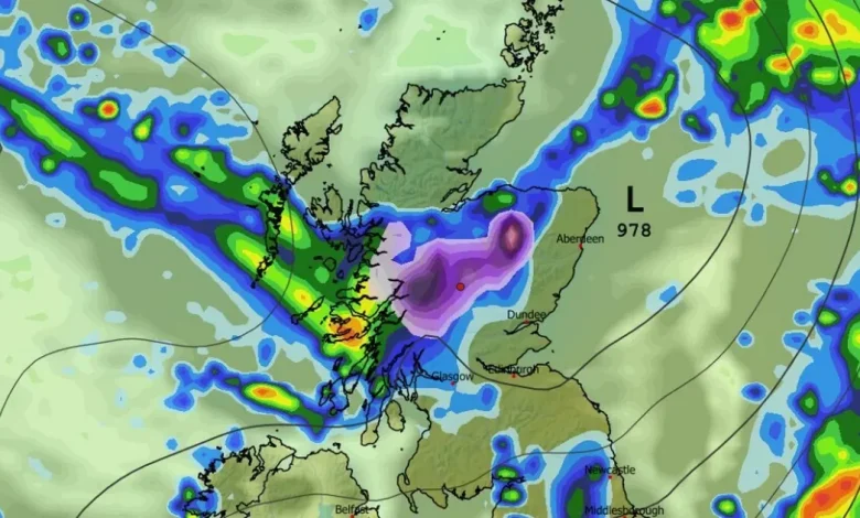
Scotland set for five days of snow with one area to see the most every day

It comes as a weather warning is in force for parts of the country
Scotland weather maps predict more snow this week(Image: Met Office)
Scotland is enduring the winter weather as gales, wind and snow are all in store for the country, with one area to set to see the most. Parts of the northwest are under a yellow wind warning for 75mph gales and now the current weather maps show five days of snow for much of the country. This latest blast is to start this week, thanks to a bout of Arctic air that’s been chilling the UK.
Forecasts previously showed snow heading for Scotland mid next week, but the latest weather map projections show the white stuff beginning to fall tomorrow for five days straight. It comes as the northwest of Scotland, including the northern isles, are under a yellow wind warning that is set to last until Friday, November 28.
According to the latest maps from WX Charts, snow is to begin in the northwest early on Friday morning. As the days go on, this bout is to slowly migrate across the top half of the country before settling down in the middle of the week.
And there is one area in particular that is due to see the highest snow fall. Maps show Glen Affric in the Highlands reaching the highest snow depth accumulation every day. Other areas expected to see less snow include Inverness, Fort William, Glencoe Pitlochry, and Aberfeldy.
Snow will become widespread by next week(Image: Met Office)
Places that are not due for snow are largely coastal on both sides, including Skye, Aberdeen, Dundee and Glasgow, according to WX Charts.
Up to 6cm is expected to fall by midday over Glen Affric but it’s not until Monday, December 1, where we see things begin to amp up. By then, 10cm is expected to accumulate here and by Wednesday, December3, this is to increase to 12cm.
Areas elsewhere can expect between one and seven centimetres of snow accumulate over this period. By Tuesday, December 2, we see conditions begin to settle down. Maps show snow dissipating, with any remaining spots expected over the northwest once again.
The Met Office long range forecast for Monday, December 1 until Wednesday, December 10 reads: “Changeable and often unsettled conditions are expected across the UK during this period.
Low pressure systems will tend to dominate meaning showers or longer spells of rain for much of the UK, though some brief drier, more settled interludes are also possible.
“The wettest weather is perhaps more likely in parts of the west, but heavy rain is possible almost anywhere at times through this period.The greatest chance of snow will probably be over northern high ground.
“Given the dominance of low pressure, strong winds are also likely at times. Overall, temperatures are predicted to be close to average, though colder conditions may occasionally encroach into northern areas.
“Some frost is to be expected where drier, clearer conditions develop overnight.”


