Happy Thanksgiving! 🦃 Big changes this weekend

FORECAST HIGHLIGHTS
-
CLOUDY FRIDAY, DRIZZLE LATE: Gray, cool Friday, with drizzle & fog developing by the evening hours
-
WARM SATURDAY: Drizzle early, mostly cloudy, with a stray storm late
-
COLD, WINDY SUNDAY: Strong cold front means a very chilly Sunday, Monday
FORECAST
FRIDAY
If you’re heading out for Black Friday shopping, don’t forget to grab a jacket and maybe an umbrella. Skies will generally stay overcast on Friday, keeping temperatures cool. Highs will be in the low-60s tomorrow. Drizzle, patchy fog, and showers will develop by the late afternoon. Damp conditions will continue overnight into the first half of the day on Saturday.
Drizzle & showers will develop Friday night (Copyright KSAT-12 2025 – All Rights Reserved)
STRONG COLD FRONT SATURDAY, COLD & BLUSTERY SUNDAY
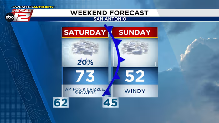
After morning clouds and drizzle, some peeks of sun will push temperatures into the 70s by Saturday afternoon. Saturday night, a strong cold front will quickly sweep through South-Central Texas. Along the front, a broken line of showers and storms is possible. Don’t expect much rainfall, as the window for rain will be small. Once the front moves through, temperatures will plummet and winds will become gusty.
Temperatures will struggle to get out of the 50s on Sunday, with overcast and windy conditions. Wind chill values will make it feel like its in the 40s most of the day.
Weekend Forecast (Copyright KSAT-12 2025 – All Rights Reserved)
COLD, DAMP MONDAY
Monday will also be cold and cloudy. Showers are also forecast to develop, making for a damp day. Once again, temperatures will struggle to emerge from the 40s. Jackets and umbrellas will be needed as we head back to work and school!
7 Day Forecast (Copyright KSAT-12 2025 – All Rights Reserved)Daily Forecast
KSAT meteorologists keep you on top of the ever-changing South Texas weather.
QUICK WEATHER LINKS
Copyright 2025 by KSAT – All rights reserved.


