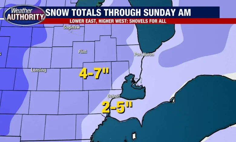
Snow shovels for all, heaviest snow to wrap up around 2 a.m. with light accumulation after

(FOX 2) – The largest snowfall of the season started Saturday afternoon and is expected to continue into Sunday.
Timeline:
The window for the heaviest snow stays open through 1–2 a.m., with lighter, but still widespread snow lingering into early Sunday before everything shuts down by lunch.
A bit of rain may mix in for eastsiders, keeping totals lower on that side of the region, but still anywhere from 2- to 5- inches. The rest of Metro Detroit should expect 4- to 7-inches by noon Sunday.
Snow totals in Michigan:
Snowfall totals as of 10 p.m., though many cities haven’t given full updates due to the holiday weekend.
- Paw Paw 7.7″
- Niles 7″
- St. Joseph 6.5″
- Daggett (western part of the upper peninsula) 4.4″
- Ypsilanti 3″
- Unionville 2.1″
- Garden City 1.7″
- Ann Arbor 1.4″
- Howell 1.2″
Snow continues to fall:
Local perspective: Snow is expected to stay steady into the night, and will leave the area around noon tomorrow.
Many roads in the Detroit metro area have snow covering the roadways. Police in the tri-county area have been reporting poor road conditions for hours. Many of the roads in those areas are reported to have icy and slippery conditions.
Numerous crashes, and cars sliding off the road have been reported throughout the night Saturday.
FOR MORE: https://www.fox2detroit.com/weather
Winter weather hits; Lions lose Frank Ragnow for season, travel delays and more
Dave Spencer and Hilary Golston host the Fox 2 News at 6 p.m. for Now. 29, 2025. Alan Longstreet says we are looking at around 1 foot of snow in the biggest storm so far this season. Scott Wolchek checks out the skating rink at Campus Martius, The Detroit Lions, fresh off announcing his return from retirement, learned that Frank Ragnow failed a physical and will miss the rest of the season, and more.
Weather


