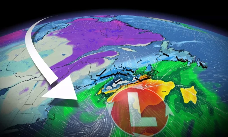
More importantly, where is this nor’easter going?
Models on Saturday were confused and uncertain, but on Sunday, models narrowed the range of solutions to a track that scrapes across the coast of Nova Scotia early Wednesday morning, before crossing eastern Newfoundland late in the day.
A track close to the coast means mixing and heavy rainfall threats increase along the coastline, but heavy snow will occur just inland where temperatures remain at or slightly below freezing.
The system will have a rich supply of Gulf moisture to work with. As such, regions that don’t experience wet snow will have the risk of more than 40 mm of rainfall.
Storm timeline
Periods of light snow will develop across the Maritimes on Tuesday evening, increasing in intensity as the night progresses.
The rain-snow line will likely gradually lift north, marking a messy transition zone. Winds will also increase during this period.
By Tuesday overnight and pre-dawn hours Wednesday morning, our centre of low pressure will pass directly south of Nova Scotia, building strong winds along the coast and heavy precipitation, including wet snow inland. Periods of light snow begin across Newfoundland.