KANSAS CITY, Mo. (KCTV) – December starts wintry, as Kansas City’s first accumulating snow of the season rolls into the area.
635 South near 70 interchange
We have declared today a First Warn Weather Day, as it is our first accumulating snow of the season and will bring hazardous and slick roads. This will bring a light, steady snow most of the day, though we will briefly have bouts of moderate snow that reduce visibility.
IMPACTS
Morning roads have already become hazardous, but heightened concerns continue into the afternoon and evening. The bulk of the snow accumulation will occur through the mid-afternoon, causing non-plowed roads to become even more slick and hazardous with accumulation.
Forecast snowfall totals have ramped up with the morning snowfall burst.(KCTV5)
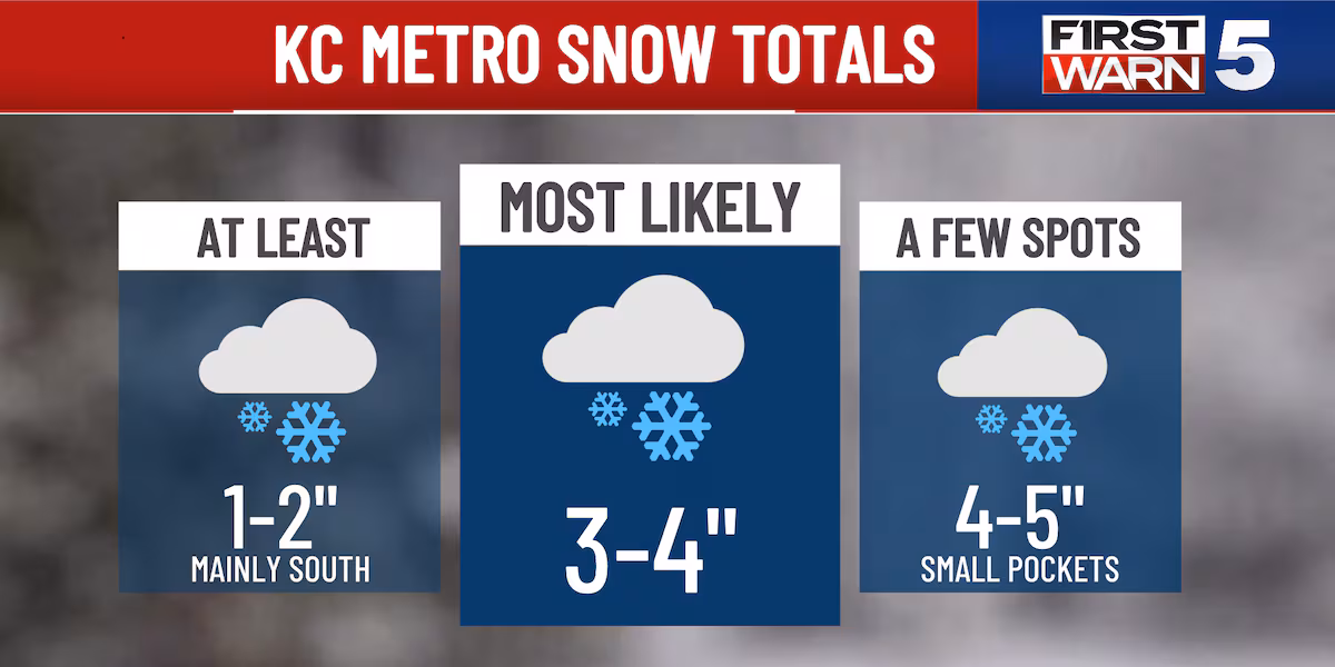
Totals for Kansas City are most likely to range from 3-5″, though there is a chance for a small zone of 4-6″ within a heavier band. The most likely area for that band will be on the north side of the metro, or even north of the metro entirely. Generally, those south of Kansas City may see less at a 1-2″ range.
TIMING
Breakdown of snow potential and impacts.(KCTV5)
Snow is expected most of the day, slowing down in Kansas City by or just before sunset. It will clear from west to east.
THE REST OF THE WEEK
It’s a wintry start to December, but today is the only precipitation in the forecast. It’s chilly today, with highs only going to the mid-20s.
Tuesday warms a bit to the mid-30s with more sunshine, and Wednesday is the warmest of the week with highs around 36.
A fresh injection of cold air will funnel in on Thursday, bringing some of our coldest weather so far this season. The morning will be in the single digits with wind chills near 0 degrees. The afternoon will see highs in the 20s. Friday brings mid-30s.
Copyright 2025 KCTV. All rights reserved.