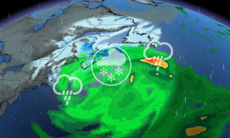
Southern Nova Scotia is expected to receive the most rain, with over 40 millimetres and wind gusts of 70-90 km/h. Forecasters warn about ponding and pooling on roads.
Cold air will remain in place farther north, including Saint John, Moncton, Charlottetown, the Annapolis Highlands and the Cobequid Mountains. These areas could receive 10-20 centimetres of snow, along with gusts of 50-70 km/h.
Commuters should expect difficult conditions Wednesday morning, with possible delays or closures on the Confederation Bridge.
LOOK: Eco-friendly tips for keeping a healthy pet and planet
WATCH: Tracking a major nor’easter into Newfoundland
Wednesday will be Newfoundland’s turn, with snow and strong winds spreading across the island in the morning and intensifying by the afternoon. Snowfall rates could reach 3-5 centimetres an hour, with coastal winds gusting to 90-110 km/h. Inland winds could reach 70-90 km/h.
The combination of heavy snow and strong winds may cause whiteout or near-blizzard conditions, slick roads and the possibility of road, school and business closures. There is also the possibility of localized power outages.
The forecast for southeastern Newfoundland remains somewhat uncertain. The Avalon and Burin peninsulas may see snow turn to ice pellets or rain as the low moves south of the region later Wednesday, potentially affecting snowfall totals.