MISSOULA— Precipitation stayed all snow for Missoula yesterday. Officially, at the airport, 4.7″ was reported!
Watch the forecast:
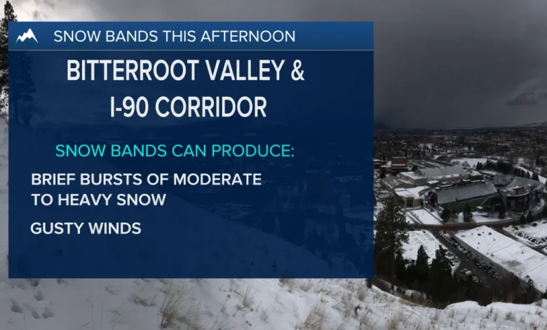
Snow bands possible this afternoon
Now, for today, another very active weather day is expected. We’ll see a brief lull in the precipitation this morning before things pick up by the afternoon.
Models are showing as precipitation returns, and snow bands could set up for areas in the Bitterroot Valley north to the I-90 corridor. Snow bands can bring quick bursts of moderate to heavy snow, gusty winds and whiteout conditions. For this reason, the Winter Weather Advisory has been extended through 11 p.m. for the Missoula and Bitterroot valleys.
Other valleys around Western Montana will see a mix of snow or rain/snow, depending on temperatures. Precipitation won’t be as steady, but scattered rain and snow showers will stick around through the weekend with highs in the upper 30s to low 40s.
Looking at next week, another round of moisture moves in; however, this will be much warmer with precipitation falling as all rain in the valleys and even a rain/snow mix at pass level. High temperatures warm into the low to mid 40s to start next week.
Watch the 24/7 StormTracker Weather stream below: