Atmospheric river could rank as high-end event, threatens flood, travel impacts

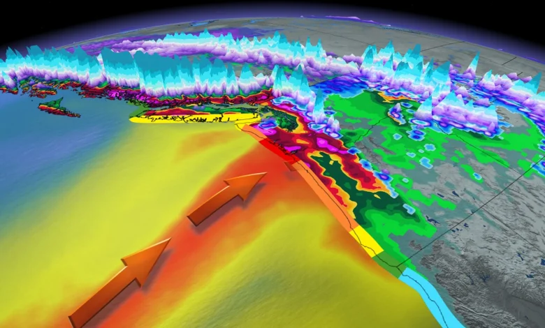
The atmospheric river moving into the West Coast on Monday will hit B.C. with AR-2 to AR-3 intensity, which means the region will see beneficial rains that could prove hazardous in spots. Folks south of the border in coastal Washington and Oregon could see significant flooding as forecasters expect the moisture supply to reach AR-4 intensity there.
DON’T MISS: Here are Canada’s worst winter roads and the riskiest times to drive
The Lower Mainland is on track for another 40-80+ mm of rain during the main event Monday through Tuesday. Lower rainfall amounts for eastern Vancouver Island, including Victoria as the strong northwesterly flow against the island’s mountains protect the area from the heavy rains.
Given the prolonged and persistent rainfall moving into the region, residents are advised to watch for pooling and ponding on area roadways. River flooding is also possible as local waterways struggle to keep up with the excess runoff.
Luckily, a dry pattern over the past week will give some breathing room for the watershed.
Heavy alpine snow as freezing levels fall into next week
Freezing levels will be highly volatile this week, fluctuating between 1100-1800 metres, leading to heavy snow at times, leading to heavy snowfall over the Coquihalla and Allision passes. Drivers could see hazardous conditions as the heavy snow comes in pulses through late Sunday.
Freezing level spikes Monday afternoon and evening before dropping sharply Tuesday.


