Here comes another cold snip as we prepare for patchy frost tonight with freezing temperatures and widespread frost on Wednesday.
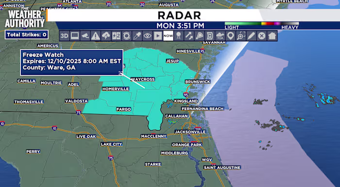
Patchy frost is possible tonight in wind-sheltered areas of inland southeast Georgia, with a Freeze Watch in effect Wednesday morning.
Freezing temperatures may be seen along the state line and in inland southeast Georgia, while much of the inland areas wake up to a light coating of frost.
. (.)
Temperatures will warm to near seasonal values Thursday and Friday with warmer temperatures this weekend.
Tonight: Clearing, cool with patchy frost for inland southeast Georgia.
Tuesday: Patchy frost inland as skies continue to clear. The steady breeze will bring an extra chill to the morning forecast. Partly cloudy skies during the afternoon with clear skies overnight. Morning lows in the 30s and 40s for SE GA, 40s to low 50s for NE FL. Afternoon highs in the 50s to low 60s. Wind: N/NE 5-15 mph. Freeze watch overnight will become a Freeze Warning on Wednesday.
. (.)
After a morning with freezing temperatures, sunny skies and warmer temperatures return Wednesday afternoon. The pleasant, seasonal temperatures, continues through the rest of the week.
Sunrise: 7:12 a.m.
Sunset: 5:26 p.m.
Copyright 2025 by WJXT News4JAX – All rights reserved.