QUAD CITIES, Iowa/Ill. (KWQC) –
Windy with bursts of snow
Snow Thursday night 2”-5”
More snow Saturday another 2”-5”+
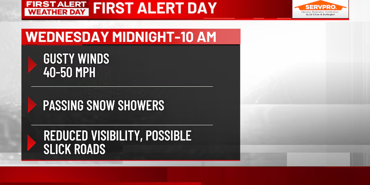
Several First Alert Days are in effect for the rest of the week, and today’s alert is for strong winds and bursts of snow that may briefly impact travel.
Two rounds of accumulating snow(kwqc)
Snow will be spotty in coverage but intense enough at times to drop visibility below a mile. While accumulations won’t amount to much, the wind will still create impacts.
Temps will fall from the 30s and 40s this morning into the 20s this afternoon, with single digit wind chills.
Another First Alert Day is in effect Thursday afternoon into Friday morning for accumulating snow in the 2”–5” range, leading to slick travel where roads aren’t treated or cleared.
Most areas pick up less then 4″ Thursday night(kwqc)
Behind this system, arctic air will arrive, setting the stage for more First Alert Days for snow and cold this weekend.
Saturday will bring highs in the single digits, and the snow will be fluffy and quick to accumulate and blow around. Another 2”–5”+ is likely, and winds Saturday night into Sunday will cause blowing and drifting and drive wind chills down to near -30º.
Safe to say it has been a very busy start to our winter season.
TODAY: Windy with snow showers. High 34º Winds: NW 15-25 mph.
TONIGHT: Mostly cloudy. Low: 16º Winds: NW 10-20 mph.
TOMORROW: Afternoon and evening snow. High 25º. Winds: SW 5-10 mph.
FIRST ALERT DAYS are issued to inform you of inconvenient, hazardous, or potentially dangerous weather in our viewing area–weather that could impact you and your family. Look for frequent updates on air, online, on our social media platforms and on the QC Weather App.
Get the latest information at your fingertips(KWQC)
Copyright 2025 KWQC. All rights reserved.