After a week, or so, of dustings and skiffs of snow, the main event arrived in time for Christmas on Tuesday.
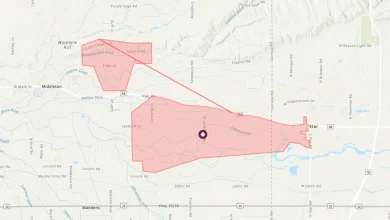
“As expected, that strong Alberta clipper did its job and ensured it would be looking a lot like Christmas ahead of December 25th,” noted CMOS Accredited Weathercaster Chris Sumner. “And based on RADAR imagery, and the reports we’re receiving this morning, it does appear we were pretty on point with the forecast of the heaviest band of snowfall, south of the Trans Canada, landing between Highway 75 in the east and Highway 83 in the southwest.”
For the latest Sun Valley Tire Road Report and Cancellation information, click here.
According to Sumner, the storm took a slightly more southerly and westerly route than models had been initially suggesting, and that led to the snowfall target landing over the western Red River Valley, Pembina Valley and parts of Western Manitoba.
“Without a doubt, we were in the 10 to 15cm range as per Environment Canada’s forecast,” he noted. “More intense bands of snowfall within the overall system more than likely brought those even higher toward the 20cm upper range in some localized areas.”
Sumner added additional light snow is expected Wednesday morning, as a trough extending off the initial low pressure system brings more flurries to the region, but only minimal additional accumulations are expected.
A reminder, a snow parking ban is now in effect in Winkler, a city-wide ban is in effect in Morden and street parking restrictions are also in effect as of this morning in Altona.
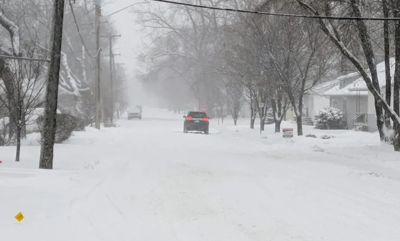
Highway going east to Friedensruh from Highway 32. 3:00pm Tuesday. Submitted by Sherry McFarlane
Cooler temperatures coming
With the low pressure system moving out of the region, surface high pressure will build behind it, which may partially clear the sky Wednesday afternoon providing a peek or two of sunshine.
“A cold front will push through the region today, and that’s why we’ll see temperatures drop by Wednesday afternoon to land around -15 to -17 degrees,” said Sumner. “We are expecting winds to remain relatively light Wednesday morning, but still potentially reaching gust of 25 to 35 km/h range at times. The combination of the light snow, the relatively dry snow on the ground and whatever breeze we may see will lead to ground drifting, some blowing snow and certainly swirling snow in highway traffic.”
He added, as another weak low pressure system approaches from southern Alberta later today, winds will shift southerly Wednesday night and overnight, bringing a brief bout of warmer air to the area with highs Thursday still below average but not too cool at -11 to -13.
For the latest Petro Canada Winkler forecast details, click here.
“As for the cold to come, the below average temperatures will last today through at least the weekend,” said Sumner. “We are in for a mini cold snap Friday and Saturday. as a trough in the jet stream develops, and an area of very cold Arctic air descends over the Prairies. The weekend is looking pretty chilly, with daytime highs currently expected in the –18 to -21 range, Saturday night could see some locations flirt with -30 heading into Sunday morning.”
The average daytime high for December 10th is -9 degrees, with the overnight low around -18.