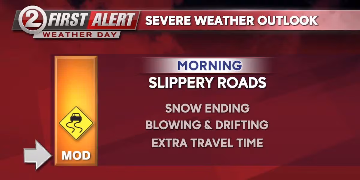
We continue to be under a FIRST ALERT WEATHER DAY through the morning commute. As expected, fluffy snow has spread across much of central and eastern Wisconsin. Overnight snowfall totals vary mostly between 3-6”, but spotty areas along and south of Highway 29 may have exceeded half a foot. The National Weather Service continues a Winter Storm Warning across the Fox Valley through 9 am. Areas just to the north and south remain under a Winter Weather Advisory.
While the snow is ending, we encourage folks to allow for extra travel time for the morning drive. Many roads will be snowpacked and slippery, especially lesser traveled roads. Allow for extra following distance between you and other cars. Give extra space to plow drivers, who are working hard to clear off the streets. Road conditions will slowly improve as the day wears on.
On the back side of this winter storm, north winds will be gusting around 30 mph. The blustery conditions, combined with the snow, may reduce visibility. Drivers should also keep an eye out for some blowing and drifting, especially in rural areas. The wind will settle down somewhat into this evening.
Otherwise, we’re expecting mostly cloudy skies today. A few leftover lake flakes may drift in from Upper Michigan. Temperatures will hover in the middle to upper 20s, before falling this afternoon.
Temperatures will soon be getting colder. Highs the next couple days will be in the upper teens and low 20s. Skies will vary from partly sunny to cloudy.
A strong arctic cold front arrives on Friday. As this push of frigid air arrives, look for afternoon and evening snow showers. Up to a powdery inch is possible. Gusty west winds will blow Friday night, as the temperatures begin to tumble.
The weekend looks bitter cold, with high temperatures only in the single digits. Low temperatures will be below zero, with harsh morning wind chills falling into the twenties below zero. With this frigid blast of air on the horizon, we’re going to make both Saturday and Sunday FIRST ALERT WEATHER DAYS for dangerous cold. Plan accordingly with your family and stay tuned for forecast updates in the days to come.
Check it out, we’ve reorganized your favorite weather graphics. They’re now in our new First Alert Map Room, which can be found here: Go to the First Alert Map Room
You can always keep our forecast handy with our free weather app. Look for the WBAY First Alert Weather App in the Apple app store and Google Play (click here on your mobile device).
WIND FORECAST:
TODAY: N/NW 10-20 G30 MPH
THURSDAY: W 5-10 MPH
TODAY: Snow ends early. Slippery morning travel. Mostly cloudy. A few flakes. Blustery, with some blowing and drifting. HIGH: 27
TONIGHT: Variable clouds. Wind weakens. Subzero chills. LOW: 7
THURSDAY: A mix of sun and clouds. Colder, but calmer. HIGH: 20 LOW: 5
FRIDAY: Cloudy again. A few snow showers. Turning blustery. Harsh chills at NIGHT. HIGH: 20 LOW: -5
SATURDAY: Frigid, with wind chills of -15 to -30. Partly cloudy and blustery. HIGH: 5 LOW: -4
SUNDAY: Bitter cold. Early chills of -15 to -30. Wind weakens. Mostly sunny. HIGH: 9 LOW: -1
MONDAY: Partly cloudy. Wind-chilly. HIGH: 17 LOW: 10
TUESDAY: Clouds increase. Not as cold. HIGH: 28
Copyright 2025 WBAY. All rights reserved.