Extremely hazardous conditions will continue across the area with strong winds and icy roads as temperatures slowly drop throughout today. More snow returns throughout the end of this week with flurries to snow showers possible, adding onto the already slick roads in the area.
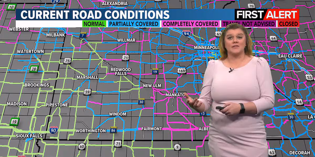
Today will start off with very hazardous conditions as ice has coated most surfaces across the area from Tuesday’s freezing rain and snow. Roads have been deemed partially to completely covered in both ice and/or snow around the area. Expect extremely slick conditions around the area. It is advised to slow down but also plan for slower moving traffic, slow downs in general, and additional travel time in general.
Temperatures today are projected to slowly drop. This means we are looking at highs in the low-20s through the morning hours and then afternoon temperatures hovering in the mid to upper-teens across the area. Winds will remain breezy for most of the day despite a gradual decline in the speeds. We are looking at winds averaging between 10 and 20 mph throughout today with gusts up to 30 mph at times. This could lead to areas of reduced visibility from blowing snow around, especially since we do have a chance of flurries later this morning and early afternoon, as well as, causing vehicles to slide a little on the roads due to pushing them around. Remember, you don’t need a lot of snow to cause problems with driving, flurries and strong winds can lead to blizzard like conditions (and have in the past on many occasions). Not that we are looking at blizzard like conditions today, especially with the winds projected to slowly calm down, it’s just to highlight that a little bit of snow can lead to extremely hazardous conditions in general.
Flurries are possible anytime through the late morning and early afternoon hours today with cloudy skies sticking around. Tonight will be on the bitter side, dropping into the single digits with flurry chances returning after 4 am. With these bitter temperatures on the way, slick conditions will remain a concern throughout the remainder of this week, especially with more snow in the forecast through Saturday.
Thursday will continue to be rather cloudy with morning snow flurries becoming snow showers by the early afternoon hours. Snow will continue into the late afternoon and early evening hours before breaking apart and becoming more like spotty flurries around the area for the late night and overnight hours. Temperatures will top out in the upper-teens by the afternoon hours with winds reaching up to 15 mph at times. Thursday night will remain cloudy with flurries around the area as temperatures drop into the low-teens by Friday morning.
Friday will then remain mostly cloudy and cold. We are looking at another cold front moving through the area. This will bring in more arctic air and snow chances. Temperatures are projected to hover in the mid-teens in the morning hours before steadily dropping into the single digits by the afternoon hours. Winds will be on the breezy side, hovering between 10 and 20 mph with gusts up to 30 mph possible. Snow is projected to move in through the morning hours before wrapping up by the afternoon hours (aside from some flurry chances possible), and then return through the overnight hours into Saturday. Temperatures are projected to drop to around -5°F by Saturday morning.
The heavier snow showers will be in spurts or pockets through Thursday and Friday so snow totals are going to range a bit across the area. This means totals will likely range from a dusting up to 4 inches possible by Friday night from the western border of southern Minnesota to the eastern border of southern Minnesota.
Saturday is going to start off mostly cloudy with snow chances in the first half of the day with partly cloudy skies and quieter conditions for the evening and overnight hours. Temperatures are projected to hover around -1°F through Saturday afternoon with winds reaching up to 10 mph. Snow showers are possible throughout the late morning and early afternoon hours before wrapping up through the afternoon and evening hours. From there, skies will become partly cloudy to mostly clear as temperatures drop to around -15°F by Sunday morning.
Sunday is going to be bitter despite a slow and steady rise in temperatures throughout the day and overnight hours. This means a warm front is likely moving through the area bringing us this warm up. Temperatures will start off well below zero in the morning hours, slowly rising into the single digits above zero by the mid to late afternoon hours, and continuing to rise into the low-teens by the overnight hours/Monday morning. As of right now, we are looking at generally fair conditions for winter time with a mix of mostly sunny to partly cloudy skies and winds reaching up to 10 mph throughout the day. Sunday night will remain partly cloudy with temperatures slowly rising as we head into Monday morning.
Next week is looking to bring some relief to the area with both warmer temperatures and quieter weather/forecasts. Monday will remain partly cloudy before mostly cloudy skies return by Tuesday. From there, skies will remain mostly cloudy through Wednesday with partly cloudy skies returning by Thursday and sticking around through Friday. Temperatures are also going to bring some relief with a slight warm up on the way! We are looking at highs in the mid-20s on Monday, the upper-20s on Tuesday and Wednesday, and the low-20s for Thursday and Friday. Winds are also projected to be on the lighter side overall, averaging between 5 and 15 mph with occasional gusts up to 25 mph at times possible. Overnight temperatures will also be slightly warmer, though still cold, as they are projected to drop into the teens and 20s by the following mornings.
Click here to download the KEYC News Now app or our KEYC First Alert weather app.
Copyright 2025 KEYC. All rights reserved.