Listen to this article
Estimated 3 minutes
The audio version of this article is generated by text-to-speech, a technology based on artificial intelligence.
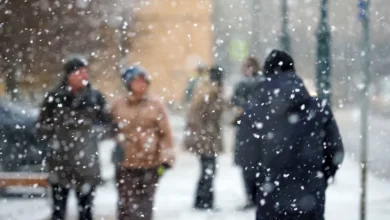
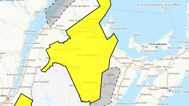
Most of New Brunswick is under an Environment Canada snowfall warning.
The warning says that 15 to 20 centimetres are expected for parts of central and northwestern New Brunswick.
While much of the province saw snowfall on Wednesday morning, the heavy snow is expected to begin Wednesday evening into Thursday morning.
According to the warning, snowfall accumulation will vary considerably because of small differences in temperatures, which are expected to hover around the freezing mark.
CBC meteorologist Tina Simpkin said an area of low pressure is moving into the Atlantic region and the warm front ahead is bringing the heaviest snow to New Brunswick.
Along with the snow, she said there will be periods of rain and a risk of freezing rain in central and southern areas of the province during Thursday morning and afternoon.
Bathurst, Campbellton, Edmundston, Fredericton, Grand Falls, Miramichi, Mount Carleton, Woodstock, Stanley, Doaktown, Blackville and Restigouche County areas are part of the warning.
The southeastern side of the province is not under a warning, but parts of south-central New Brunswick are under a special weather statement calling for five to 10 centimetres of snow and freezing rain.
Environment Canada weather warnings now use a colour-coded, risk-tiered system.
A yellow alert, which is what is in place for New Brunswick, is the baseline for watches and warnings and can be issued for a wide range of weather situations.
The weather warning currently in place is listed as having a “moderate” impact level with “high” forecast confidence.
Meteorologist says average winter temperatures likely ahead
Jill Maepea, a Fredericton-based meteorologist with Environment Canada, said the overnight system is expected to move through fairly quickly, with most of the precipitation ending by morning.
Maepea said this type of wintry weather is typical for the time of year. In Fredericton, for example, she said snow depth was between two to six centimetres at this point in the year for 2020 to 2023. But last year, there were 22 centimetres on the ground.
As of Wednesday morning, there were 17 centimetres on the ground in Fredericton, said Maepea.
“Snow systems are no stranger to December,” she said. “It’s not unusual to see this type of snowfall in December with these types of systems. So definitely on par to what we’re normally used to seeing, I want to say, in a normal winter.”
And Maepea said that, according to a three-month forecast, the rest of winter will likely prove to be normal in terms of temperatures.
“Right now, December is definitely running below normal, but if we happen to have January and February which are above normal, it will kind of average out the winter,” she said.