DON’T MISS: Canada’s December outlook holds a strong, cold start to winter
A widespread 15-30 cm of snow is possible with changeable weather conditions as the squall snakes back and forth.
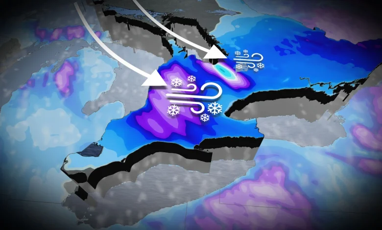
The snow squall off Georgian bay is more locked in, however, leading to the potential of very high snowfall totals. Significant snow will fall Thursday and Friday, targeting parts of Highway 400 near and south of Barrie.
A whopping 40-50+cm is possible, with a wider range of 10-30 cm possible in Bradford, Newmarket, Aurora and Uxbridge.
Snow squalls are very narrow bands of intense snow. So, it might be sunny in one area and extremely snowy in another, not far away. Expect travel disruptions if you drive on the 400 north of Toronto, in particular.
WATCH: Heavy, wet snow fills Ontario streets ahead of colder air
Uncertainty regarding holiday weather
There is a lot of uncertainty regarding our weather for the week before Christmas.
There will be a lot of Arctic air available in the pattern, but very mild air will also attempt to spread into the region. That could result in changeable temperatures and an active pattern.