The State Meteorological Agency (Aemet) has issued a detailed forecast for Thursday across the Canary Islands, highlighting periods of rough seas and strong winds. Residents and visitors are advised to remain cautious during the most critical hours.
Cloud cover and temperatures
Northern and northeastern areas of the archipelago will experience cloudy intervals, with a low probability of light, occasional rainfall during the early morning. By midday, clouds are expected to appear in western areas, while high clouds will dominate elsewhere.
Temperatures will remain largely stable, with highs reaching 22°C in Tenerife and lows around 13°C in El Hierro.
Wind and sea conditions
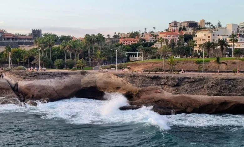
Northeast winds will blow moderately, with stronger gusts expected in the southeastern and western extremities. The southwest coasts will see calmer breezes. Winds are forecasted at force 4 to 6, causing moderate to strong sea conditions. Northwest swells will increase from 1–2 meters to 3–4 meters. Variable winds and slight seas are expected along the western coast.
Yellow alerts
Aemet has issued yellow warnings for coastal hazards in several areas:
Lanzarote: From 8:00 p.m. Wednesday to 9:00 p.m. Thursday, combined north seas reaching 4 meters offshore, with north or northwest swells exceeding 3 meters and periods of around 16 seconds at high tide.
Northern Tenerife and Gran Canaria, eastern La Palma, La Gomera, El Hierro, and Fuerteventura: Between 10:00 a.m. and 1:00 p.m. Thursday, combined north seas near 4 meters, north or northwest swells over 3 meters, and high tidal coefficients at midday.
The Government of the Canary Islands has maintained a pre-alert, active since 8:00 a.m. Wednesday.
Local island forecasts
- Tenerife: Cloudy intervals in the north and northeast, low chance of light morning rain, high clouds elsewhere, moderate northeast winds with stronger gusts in the southeast and northwest. Temperatures between 18–23°C in Santa Cruz de Tenerife.
- La Gomera: Northern clouds with low chance of morning rain, high clouds elsewhere, moderate northeast winds with stronger gusts in the southeast and west. Temperatures 18–23°C in San Sebastián de La Gomera.
- La Palma: Northern and eastern clouds with possible morning showers, high clouds in the rest, moderate northeast winds with strong gusts in El Paso and some southeast and northwest zones. Temperatures 16–21°C in Santa Cruz de La Palma.
- El Hierro: General cloudy intervals, low chance of early morning showers, moderate northeast winds with stronger gusts in southeastern and western extremes. Temperatures 14–17°C in Valverde.
- Gran Canaria: Cloudy intervals in north and northeast, low chance of early rain, high clouds elsewhere, moderate northeast winds with strong gusts in the mountains and southeast and northwest slopes. Temperatures 19–22°C in Las Palmas de Gran Canaria.
- Lanzarote and Fuerteventura: Mostly clear skies with occasional clouds in the morning and high clouds in the afternoon, moderate northeast winds with stronger gusts along the eastern and western coasts. Temperatures 17–22°C in Arrecife and 17–21°C in Puerto del Rosario.
Authorities urge maritime and coastal activities to exercise caution during these conditions, particularly during the hours of strongest winds and roughest seas.