- Western Mtn. snow likely late today
- More snow likely Friday
- Major Cold/Wind Chills Arrive Late Sunday
Wednesday Evening/ Night
Cold air and snow will quickly return to the West Virginia mountains and far southwest Virginia mountains through tonight. We’ve issued a First Alert Weather Day late today into tonight for the extreme western mountains.
For the extreme western part of the region.(WDBJ7)
The National Weather Service has also issued Winter Weather Alerts for thew same locations.
For the western mountains.(WDBJ7)
The best chance to see accumulating snow will be over western Pocahontas and Greenbrier counties, where blizzard conditions and 4-8″ of snow are possible near Snowshoe Mtn. Resort. Lighter amounts will be seen toward Highland, Tazewell, Smyth and Grayson counties. A few flakes could fly as far east as the Blue Ridge, though very minimal impacts are anticipated.
Most hometowns will only see a few flakes or up to a coating of snow Wednesday evening into Wednesday night, but the western and northern mountains could see higher amounts with more impacts.(WDBJ)
The wind will also be whipping as the front moves through Wednesday evening. High mountain ridges could gust over 45 mph with gust of 20-30 mph likely toward the Valley floor.
Near and behind a cold front, the wind will pick up and become gusty late Wednesday into Wednesday night.(WDBJ)
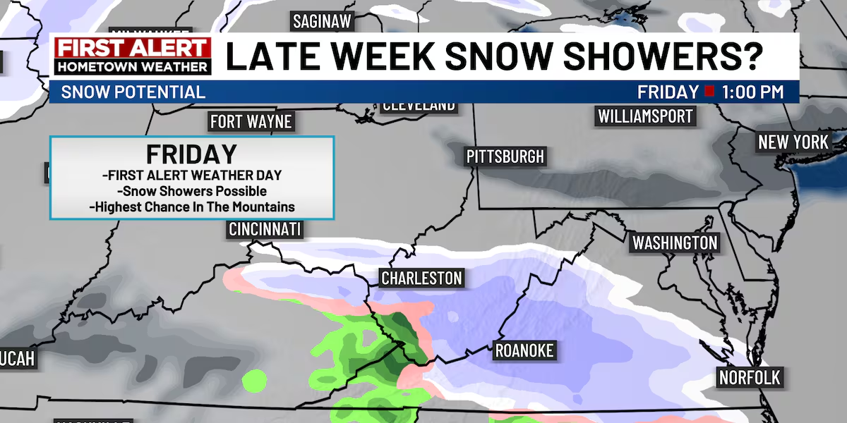
First Alert Weather Day Friday
Accumulating snow is possible Friday.(WDBJ7)
We also want to give you the First Alert on snow potential for Friday. We have issued a First Alert Weather Day on Friday to give you some visibility that we could see some impacts, mainly in the mountains right now.
Snow showers could return for our mountain hometowns later this week.(WDBJ)
Not everybody will be snow accumulation, as snow totals will be highest along the west/northwest part of the region. Very light accumulation will be possible toward the Roanoke Valley.
The highest snow totals will be limited toward the northwest part of the region.(WDBJ)
First Alert Weather Day Sunday Night/Monday Morning
This weekend, an arctic mass of air will spill southward, bring frigid temperatures and strong winds to the area. With air temperatures down into the teens and single digits, wind chills will be well into the single digits and negatives Sunday night into Monday morning.
Wind chills Monday morning will be in the single digits and negatives.(WDBJ)Wind chills Monday morning will be downright frigid.(WDBJ)
Copyright 2025 WDBJ. All rights reserved.