Listen to this article
Estimated 4 minutes
The audio version of this article is generated by AI-based technology. Mispronunciations can occur. We are working with our partners to continually review and improve the results.
Very high winds and significant snowfall is expected in many parts of the island of Newfoundland, starting Sunday night.
Environment Canada has a yellow winter storm warning in place for most of central and western Newfoundland, and the eastern part of the Northern Peninsula.
Starting Sunday night and continuing until Tuesday morning, strong winds and blowing snow are expected in this region. Forecasts predict between 20 to 35 centimeters of snowfall, with higher amounts possible in higher terrain.
Maximum wind gusts will reach 70 to 60 km/h northeasterly, and by Monday evening it will switch to 70 to 100 km/h northwesterly.
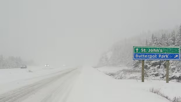
The combination of strong winds and snow will cause poor visibility, with the highest snowfall rates expected to occur during the day Monday.
Environment Canada says similar storms in the past have caused school closures and cancellation of community activities, disruptions to public services and delays and cancellations of ferry services.
Bay of Exploits, Gander
In the Bay of Exploits and Gander region, an orange winter storm warning is in place, with blowing snow and very strong winds expected to start Sunday night until Tuesday morning.
Environment Canada is also warning about coastal flooding along the northeast coast of Newfoundland from Green Bay to Bonavista Bay, starting late Monday evening until Tuesday morning.
Environment Canada has a yellow alert in place for most of central and western Newfoundland, and Northern Peninsula East, and Bonavista North. The Bay of Exploits and Gander area has an orange alert in place. (Environment Canada)
An orange alert is a level up from yellow, and indicates more significant impacts, like widespread wind, ice storms and major power outages.
Total snowfall is expected to reach 20 to 30 centimeters, with higher amounts possible in the vicinity of Bay of Exploits.
Winds will start northeasterly at 70 to 90 km/h but are expected to shift drastically to northwesterly winds at 110 to 130 km/h, Monday evening.
High winds and snow will cause poor – and sometimes zero – visibility. Environment Canada also says intense winds will cause hazardous winter conditions.
School closures, cancellations of community activities, disruptions to public services and delays or cancellations of ferry services can be expected, as well as power outages.
Environment Canada is asking that people take steps to prepare for utility outages, and secure outdoor Christmas decorations and other objects that could be lifted by strong winds.
Bonavista and Southern Newfoundland
Bonavista North also has a yellow blowing snow advisory in place. Snowfall of 15 to 20 cm is expected. Wind gusts starting at 70 km/h Monday morning are expected to turn into northwesterly 100 to 120 km/h winds by Monday evening until Tuesday.
WATCH | Here’s how the new weather alert system works:
Breaking down Environment Canada’s new weather warning system
Environment and Climate Change Canada has changed the way it classifies its weather warnings. CBC meteorologist Ashley Brauweiler explains.
Environment Canada is warning of hazardous travel and low to almost zero visibility.
Meanwhile, along the northeast coast and southern coasts of the island, special weather statements are in effect.
From Terra Nova to St. John’s, wind gusts from 60 to 80 km/h are expected, and will shift to 100 to 130 km/h Monday evening.
While a period of snow will start Sunday night, it will transition into rain Monday morning. Precipitation amounts are not expected to be significant.
But strong winds are still expected to reduce visibility Monday night.
Environment Canada meteorologist Veronica Sullivan says she expects more wind and coastal flooding warnings will be issued for eastern portions of the island during the day Sunday.
“So definitely keep an eye out for more weather warnings potentially being updated and issued throughout the day today to stay on top of it,” she said.
Download our free CBC News app to sign up for push alerts for CBC Newfoundland and Labrador. Sign up for our daily headlines newsletter here. Click here to visit our landing page.