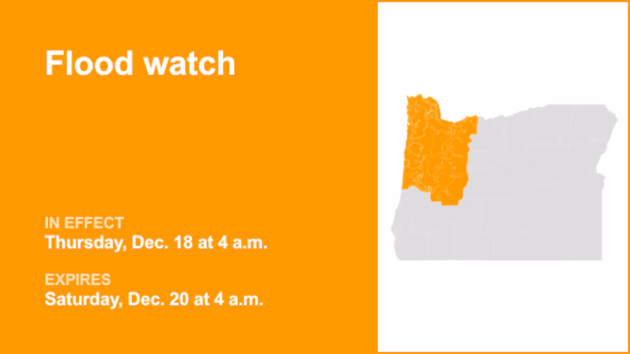
At 11:11 a.m. on Monday, the National Weather Service released a flood watch valid from Thursday 4 a.m. until Saturday 4 a.m. for Clatsop County Coast, Tillamook County Coast, Central Coast of Oregon, North Oregon Coast Range Lowlands, Central Oregon Coast Range Lowlands, North Oregon Coast Range, Central Oregon Coast Range, Lower Columbia River, Tualatin Valley, West Hills and Chehalem Mountains, Inner Portland Metro, East Portland Metro, Outer Southeast Portland Metro, West Central Willamette Valley, East Central Willamette Valley, Benton County Lowlands, Linn County Lowlands, Lane County Lowlands, West Columbia River Gorge of Oregon above 500 ft, West Columbia River Gorge I-84 Corridor, Upper Hood River Valley, Central Columbia River Gorge I-84 Corridor, Clackamas County Cascade Foothills, Cascade Foothills of Marion and Linn counties, Lane County Cascade Foothills, North Oregon Cascades, Cascades of Marion and Linn counties and Cascades of Lane County.
The weather service describes, “Flooding caused by excessive rainfall is possible.”
“Excessive runoff may result in flooding of rivers, creeks, streams, and other low-lying and flood-prone locations. Flooding may occur in poor drainage and urban areas. Storm drains and ditches may become clogged with debris. Area creeks and streams are running high and could flood with more heavy rain. Landslides and debris flows are possible during this flood event. People, structures, and roads located below steep slopes, in canyons, and near the mouths of canyons may be at serious risk from rapidly moving landslides,” describes the weather service. “You should monitor later forecasts and be alert for possible Flood Warnings. Those living in areas prone to flooding should be prepared to take action should flooding develop.”
Your guide to weather alerts: advisories, watches, and warnings
- Flash flood warning: Take action!
A flash flood warning is issued when a flash flood is imminent or occurring. If you are in a flood-prone area, move immediately to high ground. A flash flood is a sudden violent flood that can take from minutes to hours to develop. It is even possible to experience a flash flood in areas not immediately receiving rain.
- Flood warning: Take action!
A flood warning is issued when flooding is imminent or occurring.
- Flood advisory: Be aware:
A flood advisory is issued when flooding is not expected to be bad enough to issue a warning. However, it may cause significant inconvenience, and if caution is not exercised, it could lead to situations that may threaten life and/or property.
- Flood watch: Be prepared:
A flood watch is issued when conditions are favorable for flooding. It doesn’t guarantee that flooding will occur, but it signifies that the possibility exists.
When floods strike: Guidelines from the weather service for your protection
In flood-prone regions or while camping in low-lying areas, understanding and following the weather service flood safety guidelines can be a lifesaver:
Move to higher ground:
If you reside in a flood-prone region or are camping in low-lying terrain, the first step to safety is relocating to higher ground.
Follow evacuation orders:
When local authorities issue an evacuation order, promptly comply. Before leaving, secure your home by locking it.
Disconnect utilities and appliances:
If time permits, disconnect your utilities and appliances. This precaution minimizes electrical hazards during flooding.
Avoid basements and submerged areas:
Avoid basements or rooms submerged in water with electrical outlets or cords. Preventing electrical accidents is crucial.
Evacuate promptly for safety:
If you notice sparks or hear buzzing, crackling, snapping, or popping sounds, evacuate without delay. Do not enter water that may carry an electrical charge.
Refrain from walking in floodwaters:
Never attempt to walk through floodwaters, even if they appear shallow. Just 6 inches of fast-moving water can forcefully sweep you off your feet.
Seek higher ground when trapped:
Should you become trapped by moving water, reach the highest point possible and dial 911 to contact emergency services.
During heavy rain, flooding is possible, especially in low-lying and flood-prone areas. Never drive through water on the road, even if it does not appear to be deep. It takes just 12 inches of rushing water to carry away most cars, according to the weather service. Prioritize your safety by staying informed and prepared.
Navigating heavy rain: Essential safety measures for wet roads
Heavy rainfall may lead to flooding if prolonged or if there is excessive runoff. Excessive runoff can be a result of saturated ground and/or rainfall intensity. Follow these recommendations from the weather service to stay safe in heavy rain:
Beware of swollen waterways:
In heavy rain, refrain from parking or walking near culverts or drainage ditches, where swift-moving water can pose a grave danger.
Maintain safe driving distances:
Adhere to the two-second rule for maintaining a safe following distance behind the vehicle in front of you. In heavy rain, allow an additional two seconds of distance to compensate for reduced traction and braking effectiveness.
Reduce speed and drive cautiously:
If it is raining and the roads are wet, slow down. Take your foot off the accelerator and let your speed drop gradually. Never use the brakes suddenly because this may cause the car to skid.
Choose your lane wisely:
Stick to the middle lanes on multi-lane roads to minimize the risk of hydroplaning, as water tends to accumulate in outer lanes.
Prioritize visibility:
Enhance your visibility in heavy rain by activating your headlights. Be particularly vigilant for vehicles in blind spots, as rain-smeared windows can obscure them.
Watch out for slippery roads:
The first half-hour of rain is when roads are slickest due to a mix of rain, grime, and oil. Exercise heightened caution during this period.
Keep a safe distance from large vehicles:
Don’t follow large trucks or buses too closely. The spray created by their large tires reduces your vision. Take care when passing them as well; if you must pass, do so with caution.
Mind your windshield wipers:
- Heavy rain can overload the wiper blades. When visibility is so limited that the edges of the road or other vehicles cannot be seen at a safe distance, it is time to pull over and wait for the rain to ease up. It is best to stop at rest areas or other protected areas.
- When stopping by the roadside is your only option, position your vehicle as far off the road as possible, ideally beyond guardrails. Keep your headlights on and activate emergency flashers to alert other drivers of your position.
In the face of heavy rain, these precautions can make a significant difference in ensuring your safety on the road. Remember to stay informed about weather conditions and heed guidance from local authorities for a secure journey.