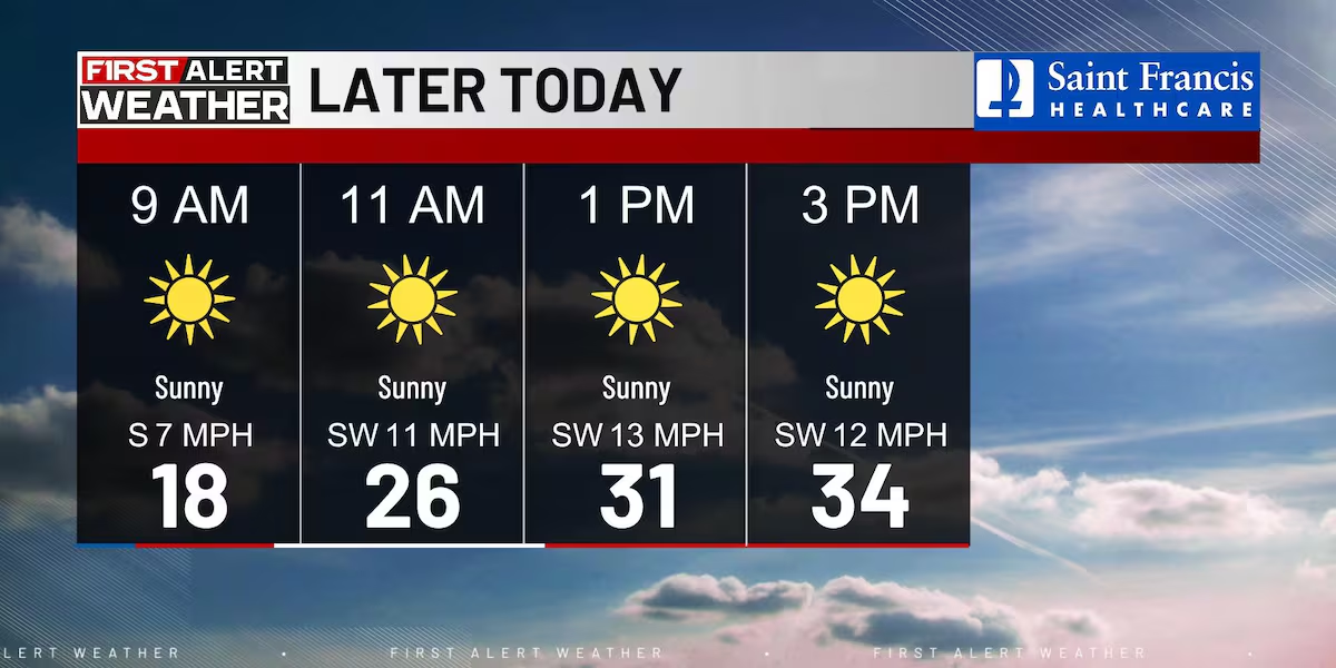
(KFVS) – We started the morning off with a bit of a cold start, but there is lots of sunshine today.
We will get a bit of a break from the bitter cold this evening.
Chief Meteorologist Grant Dade says an arctic airmass that has gripped the region is moving east, bringing relief from the cold and ushering in a significant warming trend through midweek.
Overnight, expect temperatures in the mid to upper 20s with clear skies.
Tomorrow, a warming trend begins with highs in the mid-40s and 50s expected on Wednesday. Expect partly cloudy skies.
The warming trend will continue through Wednesday and into Thursday as a cold front approaches from the west. However, this system will bring rain chances that increase on Wednesday night into Thursday. A few thunderstorms are also possible as the front moves through, though severe weather is not anticipated at this time.
The cold front will usher in a chilly finish to the work week. Highs on Friday will drop back down into the upper 30s and lower 40s as colder air settles in behind the system.
Copyright 2025 KFVS. All rights reserved.