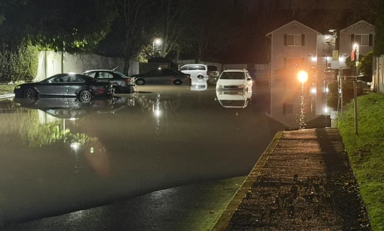
Flood concerns continue with latest round of heavy rain forecast tonight

WESTERN WASHINGTON — Dire situations continue to unfold in western Washington as another round of heavy rain is set to sweep across the region following historic flooding last week.
Aggravated flooding concerns will be the worst through Thursday, then are forecast to decrease heading into the weekend.
There will be one more push of heavy rain and wind before colder air moves in to bring snow back to the mountains for the second half of the week, replacing the upper-elevation rain that has aggravated river flooding.
Many rivers rose after Monday’s rain and will rise again through Wednesday with the next wave of heavy showers.
Rain will begin to build in the late morning and early afternoon. Expect widespread rain, heavy in spots, and building winds during the evening commute. The strongest rain and wind will occur Tuesday night, with gusts likely up to 50 mph. Rain totals may exceed an inch in the lowlands and triple that amount in the mountains.
Early Wednesday morning, lowland rain will subside, but winds will remain strong. Lingering mountain rain will transition to mountain snow throughout the day, as colder air creeps in.
Winter storm warnings are in effect for the Cascade and Olympic mountains, as more than a foot of snow is expected to fall at Snoqualmie Pass on Wednesday, with totals of three feet possible around Mount Baker.
The weather will be unsettled again on Thursday night, with more wind and lowland rain. But it’ll be colder, and more precipitation will fall in the mountains as snow, reducing the runoff draining into rivers.
On Tuesday, another levee breach prompted an immediate “GO NOW” evacuation due to a Flash Flood Warning in Pacific early Tuesday. This time, the Pacific Beach Hersco Levee failed on the White River, flooding streets and homes. Officials said evacuations were completed. Emergency officials have crews constructing a temporary wall with sandbags, and the Army Corps of Engineers is working with King County officials to assess the damage and determine next steps.
On Monday, crews made a temporary repair after a breach at the Desimone Levee along the Green River in Tukwila. The breach caused evacuations, a flash flood warning, and sent water pouring into an industrial park along the Green River. The flood warning has since been lifted.
In Skagit County, a Level 2 (Get Set) Flood Watch for all of Skagit County within the 100-year floodplain is in effect until Thursday afternoon. The alert is in addition to an ongoing Flood Warning for the Skagit River in Mount Vernon and Concrete.
In Concrete, dozens of people were forced to leave their homes due to landslide risks. The city’s Chamber of Commerce said eight homes along Eriksen Road were told to leave immediately, while 32 other homes near Burpee Hill Road are under a Level 2 notice.
In Snohomish, cleanup efforts continue after massive flooding there last week. While water levels on the Snohomish River have receded, its still running extremely high. The risk of it returning to major flood stage is possible through Friday.
A large portion of State Route 2 across Stevens Pass remains closed after major damage caused by floods and mudslides. The closure stretches from near Skykomish to Leavenworth. There is no timetable for when the stretch will reopen.
Officials with the U.S. Geological Survey and the state Department of Natural Resources (DNR) are concerned about the risk for more landslides on state highways this week.
Groundwater levels have spiked near Mukilteo. The DNR had geologists along the Interstate 5 corridor Monday. Geologists are particularly concerned about some areas in Skagit County near concrete.


