ATLANTA – Rain is expected to return to North Georgia late Thursday, bringing a period of steady showers and the potential for a few rumbles of thunder before clearing out by Friday morning.
FOX 5 Storm Team meteorologist Jonathan Stacey said conditions are about to change as the next weather system moves in.
“We’re dealing with filtered sunshine for now, but I think it’s going to be shut out tomorrow,” Stacey said. “It’s the overnight cloud cover that I’m most concerned about because when they move in, they don’t budge.”
Showers move into Georgia Thursday
Timeline:
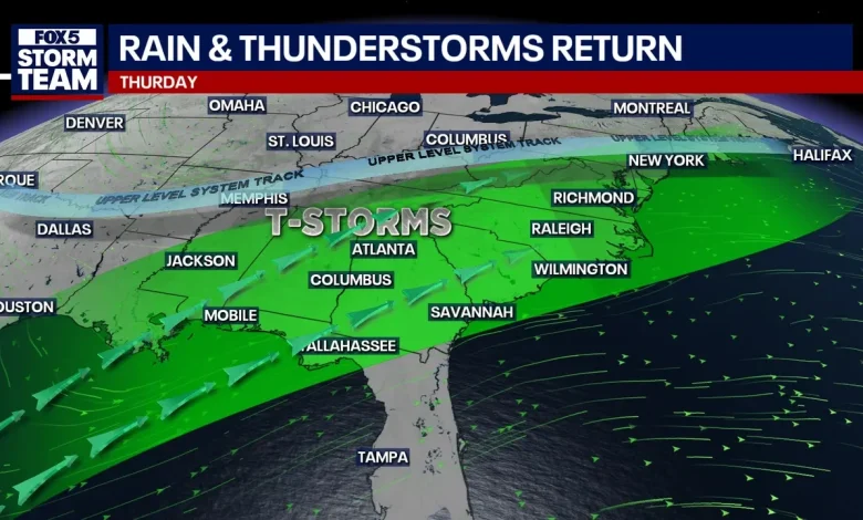
Showers developing across parts of the Tennessee Valley were expected to stay north, but forecasters said they signal a wetter pattern moving in from the south and west by Thursday.
Rain chances will increase by midday Thursday and continue into the overnight hours. Forecast models show light, isolated showers during the morning hours, followed by a more organized area of steady rain spreading across North and Middle Georgia during the afternoon and evening. Rainfall totals are expected to range from a quarter to three quarters of an inch, with isolated higher amounts near one inch possible in the North Georgia mountains.
“We’re looking at a blanket of steady rain, light to moderate in nature,” Stacey said. “Maybe the intensity builds as we get to the second half of the day.”
As a cold front moves through late Thursday night, forecasters said a brief window of thunder and lightning is possible, though widespread severe weather is not expected. By Friday morning, rain should be out of the area, leaving behind gusty winds and cooler air.
Temperatures are forecast to dip into the 30s Friday night, with some locations near or below freezing early Saturday. Highs rebound quickly, reaching near 60 degrees by Saturday afternoon under sunny skies.
Dry conditions persist in North Georgia
Dig deeper:
Drought conditions remain a concern across much of the state, even with the incoming rainfall. A recent Georgia Environmental Protection Division drought indicators report shows abnormally dry conditions across most of Georgia, with moderate drought present in large portions of the state and severe to exceptional drought lingering in parts of South Georgia. In North Georgia, soil moisture has returned to near-normal levels, but streamflows and groundwater levels remain below historical averages at many monitoring sites.
State officials reported below normal averages for the past six months across most counties, while deficits persist in several river basins in that same time period. Reservoir levels at Lake Lanier and West Point Lake were a little below average as of late November, though no water supply shortages have been reported.
Christmas week forecast
What’s next:
Looking ahead to Christmas week, long-range forecasts suggest a warmer and mostly dry pattern setting up across the region. A high pressure system is expected to dominate through much of next week, with above-normal temperatures likely across North and Central Georgia.
There are still good indications among global ensembles that a broad subtropical ridge sets up and strengthens, pointing to a high likelihood of milder-than-average conditions heading into the Christmas holiday.
While rain later this week may offer some short-term relief, forecasters caution that one system will not be enough to erase longer-term rainfall deficits, and drought conditions will continue to be monitored closely as the holiday season approaches.
The Source: This article contains an original forecast by the FOX 5 Storm Team. The Georgia Environmental Protection Division provided additional details for this article.
WeatherNewsAtlanta