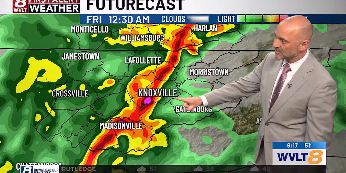
KNOXVILLE, Tenn. (WVLT) – A band of heavy rain, wind and maybe a few storms will move through the area now through 1 AM. 40-55 mph winds are possible. Secure outdoor Christmas decor and inflatables before these gusts arrive.
Multiple East Tennessee counties are under a wind advisory until 4 a.m. on Friday.
OVERNIGHT: Lows will drop into the upper 20s on the Plateau to mid 30s elsewhere by morning. Some brief snow flurries or snow showers are possible north of Knoxville from Lafollette up to Harlan, KY before 8 AM.
FRIDAY: Breezy and colder with sunshine by afternoon. Highs will only reach the low to mid 40s. Winds will be west at 10-20 mph with higher gusts. Lows will drop into the mid to upper 20s Friday night.
WEEKEND: Saturday looks pretty good with sunshine and highs in the mid to upper 50s. Clouds will return Sunday with highs in the low to mid 50s.
CHRISTMAS WEEK: Temperatures are trending colder Monday and Tuesday with highs in the 40s and 50s while going above average by Christmas Day Eve. Some showers are possible on Christmas Eve. A white Christmas is off the table with highs in the low 60s Christmas Day with mid 60s the day after Christmas.
Spencer Denton – First Alert Meteorologist
FACEBOOK: Meteorologist Spencer Denton
X: @dentonwx
Instagram: Spencer_Weather
8 Day(WVLT)
Copyright 2025 WVLT. All rights reserved.