LEXINGTON, Ky. (WKYT) – Our first system is winding down after putting down 1″-2″ of rain in some areas of the state. Now it’s time for the main show to take center stage in the days leading up to Halloween. This brings a lot of ugly into town before we clean it up on Halloween.
Here’s the latest breakdown of what to expect:
TODAY
- A few showers remain to start the day
- We have more dry than anything else into the afternoon hours for many
- Rain increases across western Kentucky during the afternoon and evening
- Heavy rains arrive from west to east later tonight
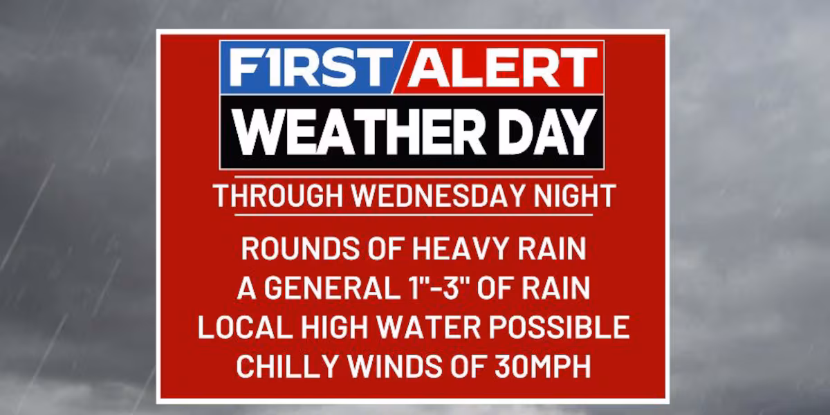
WEDNESDAY
- Widespread rain and heavy rains spin across the entire state
- Winds gust up through the day and may top 30mph at times
- Temps are chilly and may stay in the 40s
- Heavy rains continue into Wednesday night, especially in the central and east
- Local high water issues are possible during this time
THURSDAY
- Gusty showers continue across central and eastern Kentucky
- Winds are cold behind the departing storm system
- Gusts to 30mph or a tad higher will be possible
- Temps stay in the 40s for many
HALLOWEEN
- A mix of sun and clouds will be noted
- Can the northwest wind spit out some sprinkles or a shower?
- Highs are in the 50-55 degree range with 40s for trick-or-treat hours
Copyright 2025 WKYT. All rights reserved.