Published on Nov. 12, 2025, 2:32 PM
Updated on Nov. 13, 2025, 4:56 PM
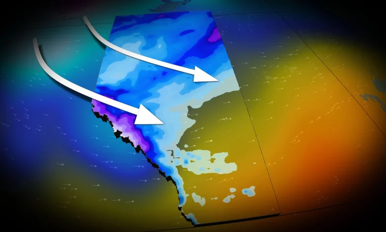
A strong cold front will bring a significant temperature drop to Alberta this week
A strong cold front is forecast to bring significant weather changes to Alberta as this week ends.
Southern Alberta will first experience a chinook on Thursday as the jet stream surges over the Rockies.
This will lead to sinking, dry air and above-seasonal conditions, with daytime highs soaring 10°C to 15°C above average.
DON’T MISS: Deadly differences: The ‘Snow Eater’ vs the ‘Devil Winds’
However, this comes with another round of gusty winds, especially near the foothills. Wind warnings are anticipated, with localized gusts exceeding 100 km/h by Thursday afternoon. Widespread winds of 60-90 km/h are expected across the region by evening.
As a low pressure system forms over central Alberta, widespread snowfall is forecast for northern regions of the province. A snowfall warning is in effect for the Rockies, with 15-30 cm of snow possible from Thursday night into Friday. The heaviest snowfall is expected over higher elevations, including sections of Highway 93.
Lower elevations, such as Banff and Jasper, are likely to see little to no significant snow accumulation.