- A Winter Weather Advisory is in effect for portions of central and east central Wisconsin today.
- A Wind Advisory is in effect for the entire area today with gusts up to 50 mph
- A more potent system arrives for Thanksgiving weekend that will bring accumulating snow to southern Wisconsin
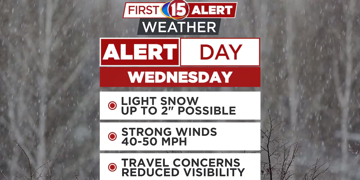
MADISON, Wis. (WMTV) – WMTV First Alert Meteorologists have declared today a First Alert Weather Day. Strong wind and periods of snow are expected across southern Wisconsin for today. A wave of low pressure continues to strengthen as it makes its way in from the west. This low pressure system will move across the state of Wisconsin and exit to the east of here by later today.
The snow showers will come to an end during the afternoon, but the wind will remain strong. We have a Wind Advisory in effect across all of Southern Wisconsin until 6 o’clock this evening. Sustained winds will be 30 to 35 mph with gusts 40 to 50 mph.
What’s Coming Up…
Cold air is also settling in across the area. High temperatures are expected to be well below average for at least a week. High temperatures over the next few days will be in the middle 20s to around 30°. even colder air will settle in next week with high temperatures only expected in the teens by Monday and Tuesday.
Looking Ahead…
Models are also indicating a stronger area of low pressure moving in from the southwest this weekend. Snow will be likely on Saturday with several inches of accumulation possible depending on the track, this wave of low pressure takes. Saturday is also a First Alert Weather Day.
That snow will be winding down Saturday night and drier weather is expected for Sunday and into the first part of next week.
Click here to download the WMTV15 News app or our WMTV15 First Alert weather app.
Copyright 2022 WMTV. All rights reserved.