- NEXT 12 HOURS: Light showers roll into Wisconsin
- THIS WEEKEND: Cooler Saturday, late showers Sunday
- NEXT WEEK: Gusty winds Monday, skies clear up
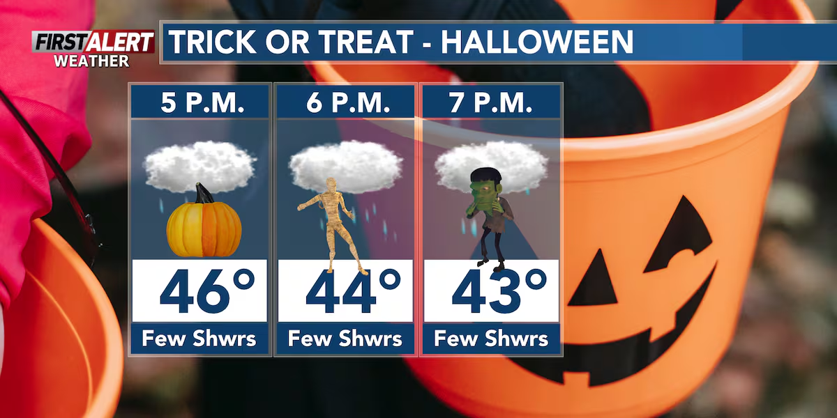
WAUSAU, Wis. (WSAW) – The forecast for Halloween 2025 will be… fittingly… gloomy.
Friday will start out with more morning fog yet again, and the fog could become fairly dense at times. Fog should clear up late in the morning. Skies will be cloudy throughout the day with highs in the mid to upper-40s this afternoon. In addition, we still have rain in the forecast Friday afternoon in the Northwoods and Friday evening further south. As we cool off into Saturday morning, some mixed precipitation or even a few flurries could mix in; no snow accumulations are expected, and rainfall is still expected to remain under 0.25” for all communities across the region.
Rain chances increase this afternoon. Rain will go from north to south.(WSAW)
What’s coming up
Saturday is expected to be our coolest day, in terms of highs, over the next week or so with highs in the low to mid-40s. Sunday will be warmer with more blue skies, but we do have much stronger winds expected on Sunday. Our next chance for rain (and the only other chance over the next week or so) arrives Sunday night and exits north central Wisconsin by sunrise Monday morning. This rainfall should be light and under 0.25” across all communities.
Our next chance for rain will be Sunday night into Monday morning.(WSAW)
Looking ahead
Monday is expected to feature our strongest wind gusts of the next week or so with winds gusting over 30 MPH at times. Although, Monday will also be the start of a stretch of days with more blue skies that continues through, at least, the first half of next week. High temperatures should moderate in the low to mid-50s for most of next week. There will be more chances for frost going forward.
7 Day Forecast.(WSAW)
Click here to download the WSAW News app or our WSAW First Alert weather app.
Copyright 2025 WSAW. All rights reserved.