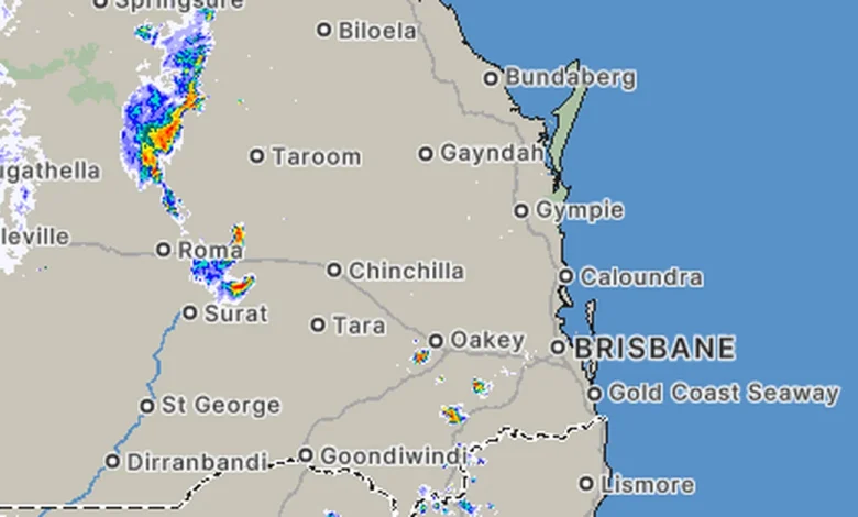
There is a chance of more severe storms across most of Queensland this evening, after Brisbane sweated through a day of high humidity.
The Bureau of Meteorology has forecast isolated to scattered showers and thunderstorms across a broad area of Queensland and north-east NSW, including inland parts of the Central Coast, Capricornia, Wide Bay–Burnett, and south-east Queensland and into the Central Tablelands and the Darling Downs, as well as the north-east coast of NSW from Port Macquarie north to the border.
A severe weather warning for the Central Highlands and Coalfields, Maranoa and Warrego and Darling Downs and Granite Belt Forecast Districts was cancelled earlier this afternoon.
The Bureau will issue more warnings if severe weather develops.
Meanwhile, a strong wind warning is in place for Moreton Bay and Gold Coast Waters and a heatwave warning is in place for the far north, including the Peninsula and North Tropical Coast and Tablelands.
Storms are then expected to ease tomorrow.