Published on Nov. 24, 2025, 12:48 AM
A long-duration snow event will impact highway travel across northern and parts of southern Ontario this week.
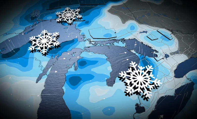
Winter will be in full swing across Ontario this week as we close out November.
Folks across the province should remain alert for the potential for heavy snow heading into this upcoming week. A major snowfall is in the cards for parts of northern Ontario, while the snowbelts of southern Ontario will watch for a multi-day lake-effect snow event.
SEE ALSO: Winter road warriors: Here’s what you should be keeping in your car
Major snowfall moves into the north late Tuesday
A new low-pressure system is set to develop south of Lake Superior late Tuesday, which will cause snowy headaches for folks across northern Ontario through Thursday.
This is expected to be a major long-duration snowfall event for all of northern Ontario, with some of the heaviest snow expected to fall over major highways through northwestern Ontario and along Lake Superior’s north shore.
A swath of heavy snow is forecast along the Minnesota border in northwestern Ontario, between Fort Frances and Thunder Bay, which will impact travel along Highway 11 between the communities, as well as the Trans Canada Highway between Thunder Bay and Dryden.
The highest-risk corridor, however, will be between Thunder Bay, Geraldton, Marathon, and Moosonee. We could see 30+ cm of snow fall over this region in addition to winds gusting off Lake Superior that could reach 60-80+ km/h. Winds will be higher along the lake’s north shore highway.