Southeast Michigan forecast: Powerful cold front to bring strong winds, snow ahead of Thanksgiving
DETROIT – Subfreezing temperatures and lake effect snow are going to make for messy travel conditions around the Thanksgiving holiday for Southeast Michigan, the National Weather Service has said.
Rain showers that have been overspreading the region today will thin out by this evening. By Wednesday morning, areas from Detroit to Ann Arbor to Flint and The Thumb will be feeling a strong cold front coming through.
This will come with gusty winds. Gusts to 40 mph are expected.
These strong wind gusts will continue into Thursday, when temperatures will drop even more and we will see a wind chill in the teens.
Lake effect snow will linger into Thanksgiving night, with total snowfall ranging from a half inch to more than 2 inches.
The snow showers will end on Friday, but the cold air will remain.
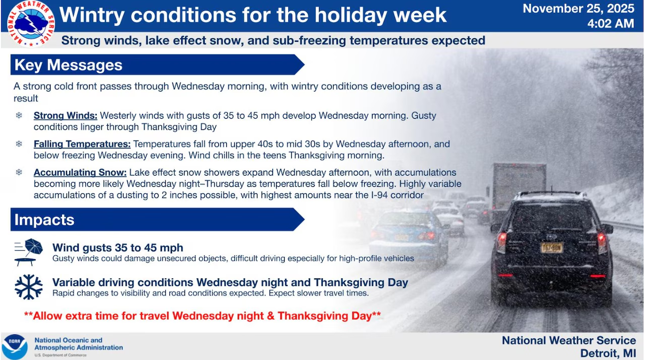
Wintry conditions with snow, blowing snow and sub-freezing temperatures are expected Wednesday and Thursday.Graphic provided by the National Weather Service
Here are the forecast highlights from the NWS office in Detroit:
Southeast Michigan residents should prepare for a multi-day weather event bringing rain, strong winds, and lake effect snow as a powerful storm system moves through the region before Thanksgiving.
Rain showers spread across southern Lower Michigan today, and the rainfall totals will hold around a quarter inch before the system shifts eastward by evening.
The weather will turn more dramatic late tonight and Wednesday morning when a powerful cold front sweeps across Lower Michigan. A line of rain showers will move rapidly through the area, with wind gusts potentially reaching 40 mph as the front passes.
As temperatures drop Wednesday afternoon, scattered rain showers will mix with snow late in the afternoon before transitioning to all snow by evening. Temperatures are expected to fall into the lower to mid 30s by sunset. Strong wind gusts will continue Wednesday night as lake effect snow develops, with the I-94 corridor forecast to see initial snow accumulation targets of 2 inches into Thanksgiving morning.
Thanksgiving Day will remain cold with temperatures hovering in the 30s and wind chill values mainly in the teens. Lake effect snow coverage will shift from the I-94 corridor toward the Ohio border and back toward Lake Michigan, with the Thumb and Tri Cities areas becoming the focus for continued snow. The lake effect event is expected to diminish by Friday.