WEATHER HEADLINES
- The snow is done, but fog may impact the Tuesday morning commute
- Warmer Tuesday into Wednesday ahead of a very cold blast of air
- Next storm system could impact us this weekned
KANSAS CITY’S FORECAST
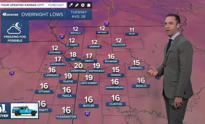
Tonight: Clearing sky with freezing fog possible, impacting elevated surfaces.
Low: 18°
Wind: S-SW 5-10 mph
Tuesday: Any freezing fog will dissipate by 10am, then partly cloudy and warmer. Watch for refreezing after 3-4 p.m.
High: 34°
Wind: SSW 10-15 mph
Wednesday: Mostly cloudy with a strong cold front arriving during the afternoon.
Low: 27°
High: 36°, near 20° by 6 PM
Wind: Becoming N 15-30 mph
Get more updates from our weather team:
View our interactive radar
Read our Weather Blog
Check out the current conditions in our area
—