Odds for a white Christmas had fallen last week after the Met Office forecast snow during the festive season — and now meteorologists in the UK have fresh information
05:00, 10 Dec 2025
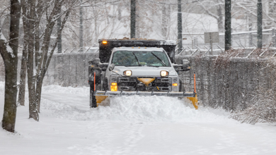
Snow occasionally falls in the UK in December (Image: PA)
The Met Office has said chances of a white Christmas are now unlikely.
Temperatures have been above average this week, despite the high winds and downpours. The mercury exceeded 14C in Teddington, southwest London, and in Chelmsford, Essex on Monday and remained balmy during Storm Bram on Tuesday.
And forecasters believe the warm pattern is set to continue throughout the month, and so significant snow is not expected anytime soon. The new data offers a different picture to what the Met Office had thought last week, when odds on a white Christmas — a single snowflake to fall anywhere in the UK on December 25 — had tumbled.
Speaking in a video published on Tuesday on the Met Office’s YouTube channel, meteorologist Aiden McGivern told of “subtle hints” the weather will become more settled after the recent downpours and gales. He said: “At the moment, there are some subtle hints of some more settled weather or, at least, less unsettled weather evolving through that week of Christmas. So there are no signs of any cold weather, or snow.
“It is mostly low pressure with spells of rain and wind, and so on… There is that promise towards the end of the year of something a little bit less unsettled.”
READ MORE: UK snow forecast shows England and Wales to be hit in days – 16 counties affectedREAD MORE: Reindeer set to be put down as council says they’re ‘dangerous wild animals’A man takes a photo in the snow in the North Yorkshire Moors after snowfall last month(Image: Getty Images)
There may, though, be snow before Christmas, according to other forecasters. Temperatures for Friday, December 19, are close to zero up and down the country and could fall to -1C in central Scotland. Maps from WXCharts show snowfall reaching as far south as Devon in southwest England, with flurries expected to cause travel chaos on December 20.
But in the days after this, temperatures will rise again sharply to above average for the time of year. For that period, the Met Office website states: “A continuation of a similar pattern to that seen through early December is anticipated, especially at first, as frontal systems from the Atlantic spread into and across the UK, interspersed with some temporary drier interludes.”
While it will be a relatively warm Christmas, forecasters understand it will be showery and foggy in places. The Met Office website adds: “Whilst outbreaks of rain and showers remains probable at times there will also be drier interludes, which may be more prolonged than of late. Some spells of strong winds are possible but in the drier periods frost and fog becomes likely.”
Odds for a white Christmas were as low as 5/4 on Thursday with Aberdeen the most likely place to see significant snowfall. However, they have now lengthened to 7/4 for most of Scotland and are as wide as 8/1 for parts of England, including sections of London.