Scattered power outages affecting several thousands Puget Sound Energy customers were reported at times around Whatcom County, closing a school and blowing down trees and branches as south winds gusted over 40 mph early Monday.
Classes at Geneva Elementary were canceled Monday from an outage that initially affected about 500 customers in the Geneva area about 6:30 a.m. Power was restored to all but about 35 homes by 9:30 a.m., according to the PSE website.
Strong and gusty winds from an atmospheric river that’s battering Western Washington could cause further outages in Bellingham and rural Whatcom County, the National Weather Service said Monday, issuing a wind advisory through Monday and another advisory from Tuesday night into Wednesday.
A wind advisory warned of south winds at 20 to 25 mph with gusts 45 to 50 mph for northwest Washington from 10 p.m. Sunday to 10 p.m. Monday. A gale warning was in effect for the northern inland waters of Whatcom County from 10 p.m. Sunday through 4 p.m. Monday.
“Gusty winds could blow around unsecured objects. Tree limbs could be blown down and a few power outages may result,” the weather service said.
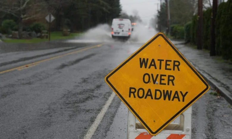
A van drove through water covering Smith Road on December 10, 2025, in Bellingham, Wash. Rachel Showalter The Bellingham Herald
For Tuesday, the advisory warns of southwest winds 25 to 30 mph with gusts 45 mph possible, weather service said Monday.
Saturated ground from previous heavy rain was expected to cause “more widespread impacts with these winds,” the weather service said.
Up to 1.5 inches of rain was forecast for the Whatcom County lowlands. Rain was forecast in the North Cascades below 7,500 feet, with 2 to 4 inches of rain possible.
Whatcom County is under a flood watch, but the Nooksack River wasn’t expected to reach flood stage this week, according to projections from the Northwest River Forecast Center.
Much of the fall snowpack in the Mount Baker wilderness has melted below 5,000-foot level, and it was snowmelt that contributed to the Nooksack River’s rapid rise last week. Only a 1-inch base remained at Heather Meadows on Monday, according to the Mt. Baker Ski Area, according to the resort’s website.
That could change this week as up to 2 feet of snow is possible, and a winter storm warning was issued for the mountains from Tuesday afternoon through Wednesday.
Snow levels will drop to around 3,000 to 4,000 feet, “bringing significant snow” to the mountains from Tuesday night into Wednesday, the weather service said.
Meanwhile, the Nooksack River continued to recede Sunday from last week’s flooding. The Whatcom County Sheriff’s Office Division of Emergency Management is still staffing its Emergency Operations Center.
With nearly 4 inches of rain in the past week, there is an increased threat of landslides for Western Washington.
Rain is forecast in the Whatcom County lowlands through this week, with daytime high temperatures dropping from the 50s to a more seasonable mid-40s. Overnight lows will drop into the 30s by the ends of this week.
This story was originally published December 14, 2025 at 1:30 PM.
Robert Mittendorf
The Bellingham Herald
Robert Mittendorf covers civic issues, weather, traffic and how people are coping with the high cost of housing for The Bellingham Herald. A journalist since 1984, he’s also a volunteer firefighter for South Whatcom Fire Authority.