The weekend weather forecast looks unsettled over the coming days with rain or showers, as well as turning cooler if not colder from Sunday.
However, high pressure will bring mostly dry and fairly calm conditions from later next Tuesday, lasting for much of the Christmas period, according to Met Éireann.
Starting with today (Friday, December 19), it will be blustery to begin with passing heavy showers and local hail.
However, winter sunshine will develop more widely this afternoon and brisk southerlies will ease, as showers become confined to west and north-west counties. Highest temperatures of 7°C to 10° are expected.
It will be dry and clear for much of tonight. Some well scattered showers will begin to feed up from the south-west later though, along with freshening south to south-east winds.
Lowest temperatures tonight will range from 3° to 7°, coldest for Ulster.
Weekend weather
Saturday will be rather windy to start with some scattered showers. Rain in the south-west will slowly push north-eastwards during the day with scattered showers following from the west.
Highest temperatures will range from 7° to 11°. Brisk south-east winds will slowly ease off but with some mist in places later too.
Saturday night will be a very cold and calm night with frost and ice developing under clear skies. Some freezing fog is possible across Ulster and the midlands too.
Showers will move into south-east and east areas later, locally turning wintry. Lowest temperatures of -2° to +2° are expected.
Sunday will be cooler than recent days with showery rain moving in across the country on an easterly breeze, with the chance of the odd wintry shower. Highest daytime temperatures will reach from 4° to 8°.
Outlook for next week
On Monday, further showery rain is expected, mainly across Ulster and Leinster with more persistent spells possible across these regions.
Overnight fog may linger in places and there may be frost and ice in places to begin too. Highest temperatures of 4° to 8° are expected, in just a light easterly breeze.
Some further showery rain is forecast for Tuesday, moving further west this time, while becoming drier elsewhere. Highest temperatures will range from 5° to 8° with just light variable breezes with mist and fog places also.
It will likely be rather cold for Christmas Eve (Wednesday, December 24) and Christmas Day (Thursday, December 25) – dry and quiet with crisp winter sunshine, but with frost and ice to begin and end each day.
There will be the chance of a few coastal showers up along the east coast, in a light to moderate east to north-east breeze.
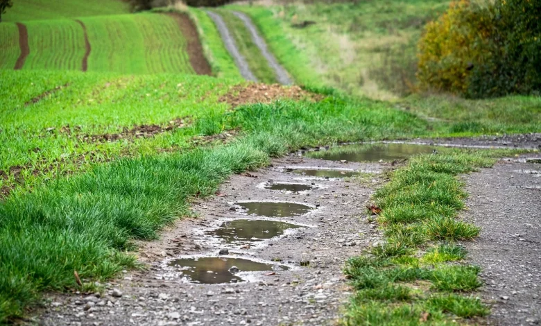
Field conditions
Currently, all well and most moderately drained soils are saturated while some moderately and all poor drained soils are waterlogged.
There will be further spells of rain and showers for the coming days, but with indications for drier and more settled weather early next week, conditions will likely improve somewhat.
All soils will likely remain saturated with a recovery possible in some waterlogged soils.