- Calmer and colder conditions for Black Friday.
- Significant snowfall is expected Saturday and Saturday night across southern Wisconsin, with widespread totals over 6 inches possible.
- Below-normal temperatures will persist through next week, with highs mainly in the 20s and lows in the single digits.
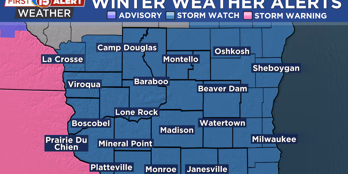
MADISON, Wis. (WMTV) – A First Alert Day is in place for Saturday and Sunday as a strong winter storm is expected this weekend, bringing accumulating snow to all of southern Wisconsin. The heaviest snow will likely fall from late Saturday morning through Saturday night, with widespread totals exceeding 6 inches. Eastern counties may get even more due to lake enhancement, and a Winter Storm Watch is in place for all of southern Wisconsin.
What’s Coming Up…
Forecast confidence is high that this system will produce steady snow because multiple weather features—surface low pressure, upper-level lift, and a favorable storm track—are lining up. While models still vary on exact precipitation amounts, even the lower estimates support significant snowfall. This system will be cold enough for efficient snow production, meaning fluffier snow with higher snow-to-liquid ratios.
Looking Ahead…
After the snow ends early Sunday, breezy and cold conditions will follow, with some minor blowing or drifting possible. The week ahead stays colder than normal as polar high pressure settles in. Occasional light snow chances may appear, but temperatures will remain wintry with highs mostly in the 20s and nights dropping into the single digits.
Click here to download the WMTV15 News app or our WMTV15 First Alert weather app.
Copyright 2022 WMTV. All rights reserved.