LEXINGTON, Ky. (WKYT) – A slow-moving boundary continues to hang out across the region today and this will be the focal point for more heavy rain in the days ahead. This active pattern will lead us into a big change to Winter as we go into Thanksgiving Week and Weekend.
Lots of low clouds and some fog will likely be common for much of the day with areas of drizzle or a light shower. Temps across the northern half of the state stay in the 40s with 60-65 in the far south and southwest.
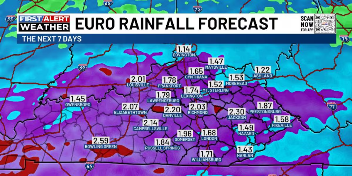
This similar temperature boundary hangs around for Thursday as a stalled front starts to get active again. Low pressure develops to our west and rolls eastward along the front Friday into early Saturday. That means additional waves of heavy rain producing showers and some thunder.
This has all the makings of another 1″-2″ rainfall for much of Kentucky, and this will bring the weekly total to greater than 3″-4″ for some.
All of this leads us into ANOTHER big storm system to start our Thanksgiving Week. This moves in from the southwest with more in the way of heavy rains from late Monday through the busy travel day on Wednesday. Cold air then crashes in behind this system for Thanksgiving Day and takes us through the big holiday weekend.
Will we have a wave of low pressure to bring some winter weather as the cold air crashes in? Will another system develop at some point during the weekend? Both of those are the questions we will be trying to answer in the coming days.
Copyright 2025 WKYT. All rights reserved.